This Portland, Oregon neighborhoods guide starts with the one map worth memorizing: the Willamette River splits the city east from west, Burnside Street splits it north from south, and every address begins with one of six prefixes (N, NE, SE, S, SW or NW) that tells you which slice you’re in. For a first visit, the neighborhoods that matter are downtown, Old Town and the Pearl District on the west bank, Nob Hill at the edge of Forest Park, and across the river the Central Eastside, Hawthorne, Division, Alberta and Mississippi. Each one gets what it’s best for, a half-day walking loop and a note on how transit reaches it.
It’s written for visitors deciding where to spend their hours, not where to buy a house. The caveat: Portland’s best neighborhoods are long main streets more than compact squares, so the liveliest stretch of Hawthorne or Alberta is a mile or more from the nearest MAX station, and a bus, a bike or your feet do the connecting. Transit lines, event schedules and the anchors named here were checked September 24, 2026 against TriMet, the City of Portland and the venues’ own websites.
On this page: How the map works · What each is best for · West side · Close-in east side · Southeast · North and Northeast · Walking loops · Transit · What to skip · FAQ
How does Portland’s map work?
Portland is one of the easier American cities to navigate once you know three rules. First, the river and Burnside divide the city into sections, and every street address carries the section’s prefix. There used to be five. South Portland became the sixth on May 1, 2020, when more than 6,000 addresses east of SW Naito Parkway switched from SW (with awkward leading zeros) to S. The city recognizes 95 official neighborhoods inside those six sections, each with its own volunteer association, but a visitor needs only a dozen or so.
Second, the address tells you the cross street. On an east-west street, drop the last two digits of the house number and you have the nearest numbered avenue: Cartopia, at 1207 SE Hawthorne Boulevard, sits at SE 12th Avenue. Avenues count outward from the river on each bank, so NW 23rd is 23 blocks west and SE 39th is 39 blocks east.
Third, Northwest’s streets run in alphabetical order north of Burnside: Couch, Davis, Everett, Flanders, Glisan, Hoyt and on up to Thurman and Vaughn, which is why the area is called the Alphabet District. Downtown’s blocks are small, 200 feet on a side, so walking ten of them is less of a commitment than it sounds.
| Section | Where it is | Neighborhoods for visitors | Main transit |
|---|---|---|---|
| SW (Southwest) | West of the river, south of Burnside | Downtown, Goose Hollow, the West Hills | Every MAX line downtown; the streetcar |
| NW (Northwest) | West of the river, north of Burnside | Old Town Chinatown, the Pearl, Nob Hill, Slabtown | Streetcar; MAX on the transit mall and 1st Ave |
| S (South) | East of SW Naito Parkway, south of downtown | South Waterfront and the Aerial Tram | Streetcar, MAX Orange Line, the tram |
| N (North) | East of the Willamette, west of N Williams Ave | Mississippi, Kenton, St. Johns | MAX Yellow Line; buses |
| NE (Northeast) | East of Williams, north of Burnside | Lloyd, Alberta, Hollywood | MAX Red, Blue and Green; buses |
| SE (Southeast) | East of the river, south of Burnside | Central Eastside, Hawthorne, Division, Mount Tabor, Sellwood | Streetcar loops, MAX Orange Line, frequent buses |
Which Portland neighborhood is best for what?
Here’s the short version for planning. Most visitors do two or three of these in a day, pairing neighbors on the same side of the river.
| Neighborhood | Best for | Time to spend | Getting there | Pair with |
|---|---|---|---|---|
| Downtown (SW) | Museums, shopping, the waterfront | Half a day | Every MAX line | Old Town |
| Old Town Chinatown | Lan Su, the Saturday Market, the old city | 2-3 hours | MAX Red and Blue; the transit mall | The Pearl |
| Pearl District (NW) | Powell’s, galleries, parks, dinner | Half a day | Streetcar | Old Town or Nob Hill |
| Nob Hill (NW) | Shops and cafes on NW 23rd; Forest Park | Half a day | Streetcar NS Line | Forest Park |
| South Waterfront (S) | The Aerial Tram and the river path | 1-2 hours | Streetcar, MAX Orange Line | Tilikum Crossing to OMSI |
| Central Eastside (SE) | OMSI, the Esplanade, breweries | Half a day | Streetcar loops, MAX Orange Line | Hawthorne |
| Lloyd and Rose Quarter (NE) | Concerts, games, conventions | Event nights | MAX Red, Blue and Green | Central Eastside |
| Hawthorne and Belmont (SE) | Vintage shops, an old movie palace | Half a day | Line 14 bus | Division |
| Division and Clinton (SE) | Restaurants | An evening | FX2 bus | Mount Tabor |
| Mount Tabor (SE) | A volcano park and sunset views | 1-2 hours | FX2 bus or a car | Division |
| Sellwood-Moreland (SE) | Antiques, Oaks Park, river wetlands | Half a day | MAX Orange Line (east edge); a car helps | Oaks Bottom |
| Alberta Arts District (NE) | Murals, galleries, Last Thursday | Half a day or an evening | Line 72 on Killingsworth | Mississippi |
| Mississippi and Williams (N) | Shops, live music, bars | Half a day | MAX Yellow Line | Alberta |
| Hollywood (NE) | The Hollywood Theatre | A movie night | MAX Red, Blue and Green | Grant Park |
| St. Johns (N) | The St. Johns Bridge and Cathedral Park | Half a day | Frequent buses; a car helps | Kenton |
For what to see inside each one, our list of things to do in Portland, Oregon has hours and prices. This page is about the neighborhoods as places: their shape, their anchors and how to walk them.
West side neighborhoods
The west bank holds the old commercial city, packed into a flat strip between the river and the West Hills. It’s the easiest part of Portland to walk and the best served by transit.
Downtown
Downtown is the civic and shopping core, from the river west to I-405, and Pioneer Courthouse Square is its living room: a brick plaza where all five MAX lines meet and most of the city’s big events happen. South of the square, the South Park Blocks run through the cultural district, past the Portland Art Museum (closed Mondays; its Mark Rothko Pavilion opened in November 2025) to Portland State University, where the Portland Farmers Market fills the blocks on Saturdays. The Arlene Schnitzer Concert Hall is on Broadway; Tom McCall Waterfront Park lines the river.
Walking loop (about 2.5 miles, 2-3 hours): start at Pioneer Courthouse Square, walk south along Broadway to the South Park Blocks and the art museum, continue to PSU (on a Saturday morning, the farmers market), then head east to the river and follow Waterfront Park north past Mill Ends Park, the two-foot-wide city park in the median of SW Naito Parkway at Taylor, to the Saturday Market’s home by the Burnside Bridge.
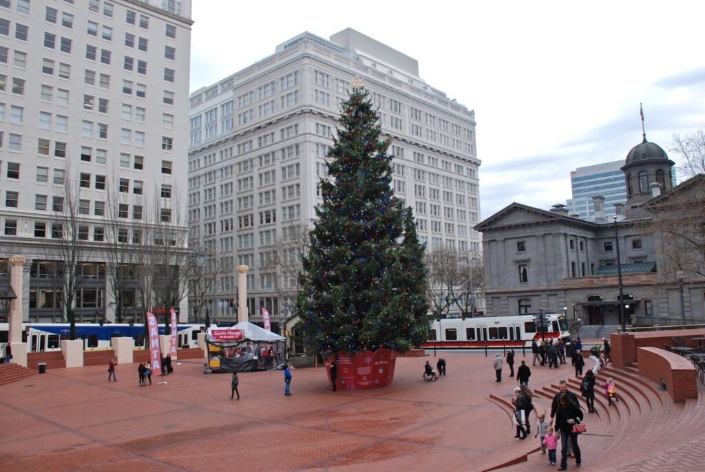
Best for: a first morning, rainy days and car-free trips. Think twice if you want a neighborhood feel after dark; offices empty out by early evening, and the Pearl, ten minutes north, stays livelier.
Old Town Chinatown
Old Town is the oldest part of the city, straddling Burnside between downtown and the Pearl. Its anchors are close together: the Chinatown Gate at NW 4th Avenue and Burnside, Lan Su Chinese Garden a few blocks north, the 1888 Skidmore Fountain, and the Portland Saturday Market on the riverfront (Saturdays only, 10 a.m. to 5 p.m., through December 19, 2026). Union Station, the city’s Amtrak terminal, marks its northern edge at 800 NW 6th Avenue.
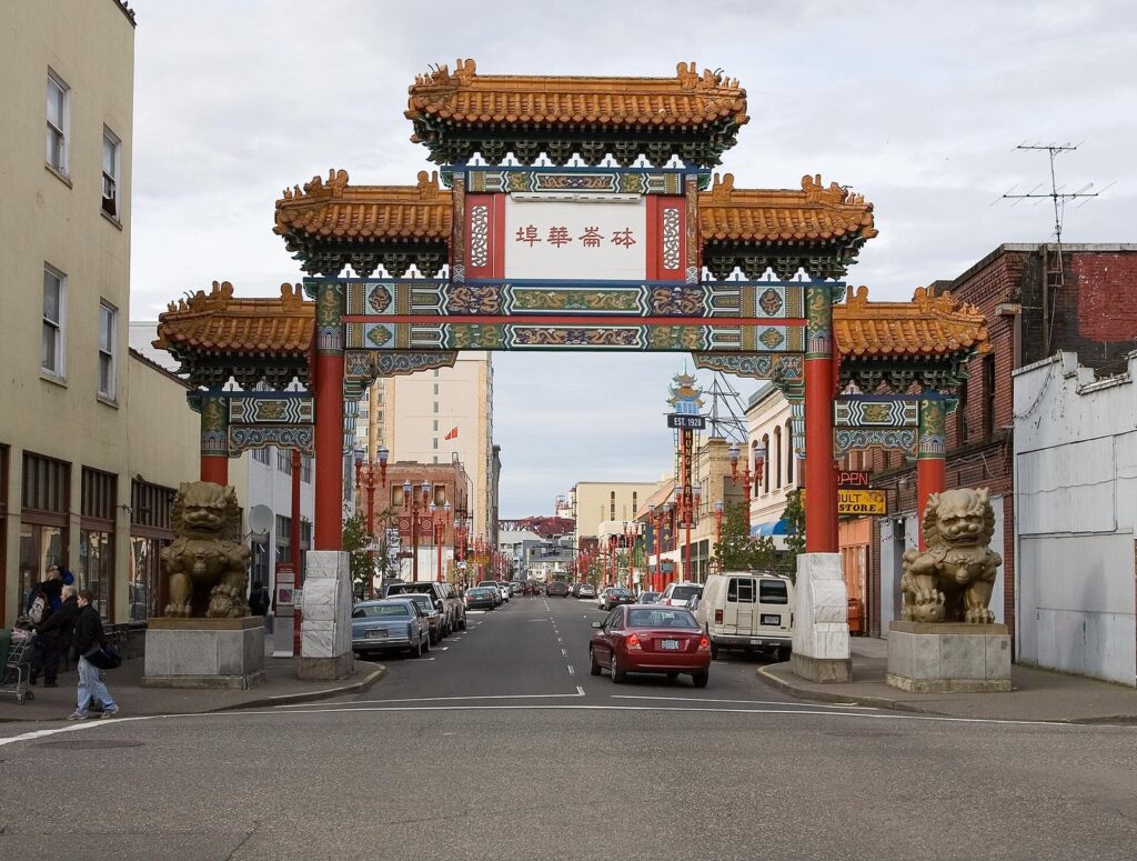
Walking loop (about 1 mile, 2 hours with Lan Su): Skidmore Fountain, north through the gate, Lan Su (open daily 10 a.m. to 5:30 p.m., last entry at 5), then north and west to Union Station’s clock tower and into the Pearl. It combines naturally with the Pearl loop below.
Think twice if you’re here late at night. Old Town has the city’s densest cluster of clubs and some blocks with visible street homelessness; by day, it’s the most historically layered corner of Portland.
Pearl District
The Pearl is a former rail yard and warehouse district north of Burnside, now loft buildings, galleries, restaurants and a string of small parks. Powell’s City of Books fills a whole block on its southern edge at W Burnside. Jamison Park has a stepped fountain where children wade in summer; Tanner Springs Park, a few blocks north, is a small urban wetland framed by a wall of old railroad rails; the Fields Park sits by the Fremont Bridge at the neighborhood’s north end. The streetcar’s NS Line and loops run straight through it, and MAX stops along its eastern edge.
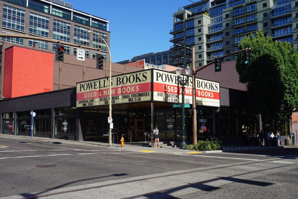
Walking loop (about 2 miles, 2-3 hours): from Union Station, walk west to Tanner Springs Park, south to Jamison Park, north again to the Fields Park beside the Fremont Bridge, then back south through the gallery blocks to Powell’s. Save an hour for the bookstore; it takes it.
Nob Hill and the Alphabet District
Nob Hill is the residential Northwest built around NW 23rd Avenue, whose main blocks between Burnside and Thurman are lined with old houses turned into shops and cafes. NW 21st, two blocks east, is the quieter restaurant street. North of Nob Hill, Slabtown is newer and denser, and the West Hills rise steeply to the west, which is why this is the neighborhood for Forest Park: the Lower Macleay trailhead, the usual way into the park’s 80-plus miles of trails, is about a 15-minute walk from the north end of 23rd.
Walking loop (about 2 miles, 2 hours): ride the streetcar to NW 23rd and Marshall, walk 23rd south to Burnside, cross over to NW 21st and walk it north. Add Lower Macleay and the trail along Balch Creek for a half-day with a forest in it.
South Waterfront and South Portland
South Waterfront is Portland’s newest district, a strip of towers along the river in the S section. Visitors come for one thing, the Portland Aerial Tram, which climbs 500 feet to Oregon Health & Science University on Marquam Hill ($9 round trip; no service on Sundays or holidays). The Willamette Greenway path runs along the river, and Tilikum Crossing, the car-free bridge, links the district to OMSI on the east bank. Budget one to two hours and pair it with the Central Eastside.
Goose Hollow and the West Hills
West of downtown, Goose Hollow is home to Providence Park, where the Timbers and Thorns play, and the gateway to the West Hills. Washington Park is the reason to go up: the Japanese Garden (closed Tuesdays), the International Rose Test Garden, Hoyt Arboretum and the Oregon Zoo, reached by MAX at a station 260 feet underground. The park’s free shuttle runs every 30 minutes from 10 a.m. to 4 p.m. from October through March and every 15 minutes the rest of the year. Pittock Mansion’s grounds, open until 9 p.m., have the best free view in the city.
The close-in east side
Across the river, the blocks nearest downtown were industrial for most of the 20th century. They’re now where Portland eats, drinks and makes things.
Central Eastside and Buckman
The Central Eastside runs along the east bank from Burnside south to OMSI, a district of warehouses, breweries, distillery tasting rooms, coffee roasters and restaurants, with Buckman’s older houses rising behind it. The Vera Katz Eastbank Esplanade follows the river for 1.5 miles between the Hawthorne and Steel bridges, including a 1,200-foot floating walkway. Revolution Hall, an 850-seat music venue in a former high school, is the neighborhood’s big stage, and Scotch Lodge on SE 9th Avenue took the James Beard Award for Outstanding Bar in 2026. Several of the restaurants in our guide to the best restaurants in Portland are here, including Kann, Kachka and Nostrana.
Walking loop (about 3 miles, 2-3 hours): from OMSI (closed Mondays), walk the Esplanade north to the Steel Bridge, then return south through the warehouse blocks along SE Water and 2nd, stopping for a taproom or lunch. Cross back on the Hawthorne Bridge to finish downtown.
Lloyd District and the Rose Quarter
The Lloyd District holds the Oregon Convention Center, the Moda Center and big hotels, and it’s the best-connected spot on the east side: MAX Red, Blue and Green lines and the streetcar loops all stop here. It’s also the least interesting to walk. Come for a concert, a game or a convention, and go elsewhere for an afternoon.
Southeast neighborhoods
Southeast is the city’s biggest section and its most characteristic: grids of old houses, long commercial streets and big parks. Buses run the length of each main street, so pick one and walk it.
Hawthorne and Belmont
SE Hawthorne Boulevard is Portland’s classic east side shopping street: vintage clothing, records, used books and cafes between roughly SE 30th and SE 50th. The Bagdad Theater & Pub, a single-screen movie palace run by McMenamins, is the landmark, and Cartopia’s late-night food carts sit at the boulevard’s western end at SE 12th. Belmont, a few blocks north, is a quieter version with more bars. TriMet’s Line 14 runs along Hawthorne every 15 minutes or less for most of the day, every day.
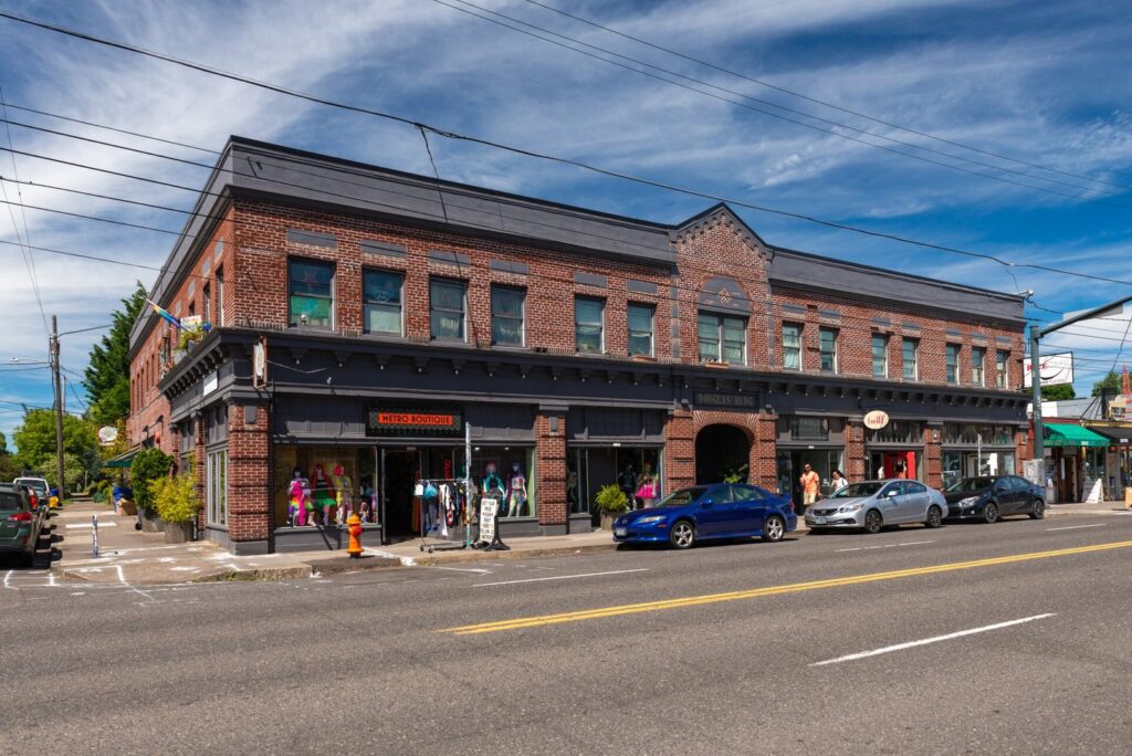
Walking loop (about 3 miles, 3 hours): take Line 14 to SE 30th and Hawthorne, walk east past the Bagdad to about SE 50th, then turn south to Division and walk it back west to the 30s for an early dinner. Shorten it by turning around at SE Cesar E. Chavez Boulevard (39th). Laurelhurst Park, about ten blocks north of Hawthorne on Cesar E. Chavez, is the place to sit under big firs.
Division and Clinton
SE Division Street is the east side’s restaurant row, dense from the 20s through the 30s and scattered beyond. It’s an evening neighborhood more than a sightseeing one: walk it, read menus in windows and pick dinner. SE Clinton, a few blocks south, is a calmer residential street with a small cluster of bars and cafes. The FX2-Division bus runs every 12 minutes for most of the day, every day, from downtown out past Mount Tabor, which makes Division the easiest east side food street to reach without a car.
Mount Tabor and Montavilla
Mount Tabor is a park on an old volcanic cinder cone in outer Southeast, with forest paths, historic reservoirs and a summit that looks west over the whole city. Go for sunset, which lands around 9 p.m. in late June and around 4:30 p.m. in December. Coquine, one of the city’s most admired restaurants, sits at the foot of the hill, and Montavilla, just east, has a small main street along SE Stark. Allow an hour for the summit loop, more with a picnic.
Sellwood-Moreland
Sellwood, in the far south of Southeast, feels like a small town. Antique and vintage shops line SE 13th Avenue, the Sellwood Bridge crosses the river at its west end, and below the bluff Oaks Bottom Wildlife Refuge protects wetlands along the Willamette. Oaks Amusement Park, at 7805 SE Oaks Park Way, has 44 acres of rides open from mid-March through October and a historic roller rink, with a Wurlitzer pipe organ, open year-round (open skate daily except Mondays). The Springwater Corridor trail runs past both; check the city’s page for closures before planning a walk or ride on it.
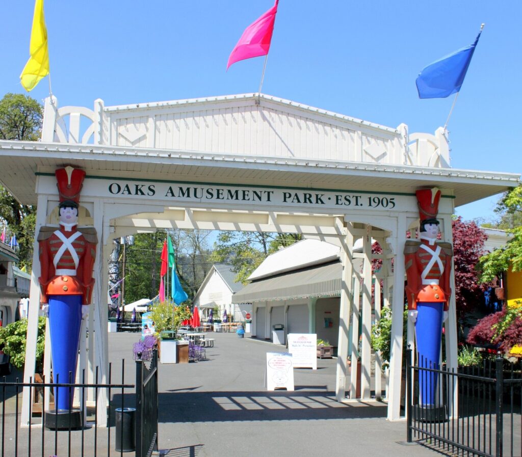
Getting there: the MAX Orange Line’s SE Tacoma/Johnson Creek station is on Sellwood’s eastern edge, but a car or bike makes the neighborhood much easier to string together with Oaks Park.
Farther out: the Jade District and beyond
Outer Southeast rarely makes visitor lists, but the Jade District along SE 82nd Avenue is one of the city’s centers of Asian restaurants and grocery stores, and it rewards anyone who travels for food. It’s a driving or bus trip, not a walking neighborhood.
North and Northeast neighborhoods
North and Northeast Portland mix old streetcar suburbs, artists’ corridors and, in North, a working riverfront. Two main streets, Alberta and Mississippi, carry most of the visitor interest; two more places, Hollywood and St. Johns, deserve a detour.
Alberta Arts District
NE Alberta Street is a long, low commercial strip, roughly from NE Martin Luther King Jr. Boulevard to the 30s, painted with murals and lined with galleries, restaurants and small shops. Its signature event is Last Thursday, an art walk from 6 to 9 p.m. on the last Thursday of the month, ten months a year in 2026 (the next one falls on October 29). Expect street vendors, music and crowds on those evenings, and a quieter, easier street the rest of the month. Line 72 runs along Killingsworth, three blocks north.
Walking loop (about 2 miles, 2 hours): walk Alberta east from around NE 10th Avenue to the 30s, looking for murals on side walls, and return on the other side of the street, or catch Line 72 back west from Killingsworth.
Mississippi and Williams
N Mississippi Avenue is a compact main street of shops, bars and restaurants in old storefronts, with Mississippi Studios as its music venue. Parallel N Williams Avenue, a few blocks east, is newer, lined with restaurants and bars along one of the city’s busiest bike routes. The MAX Yellow Line’s Albina/Mississippi station is about a 10-minute walk from the main blocks, which makes this the most transit-friendly of the east side’s character streets.
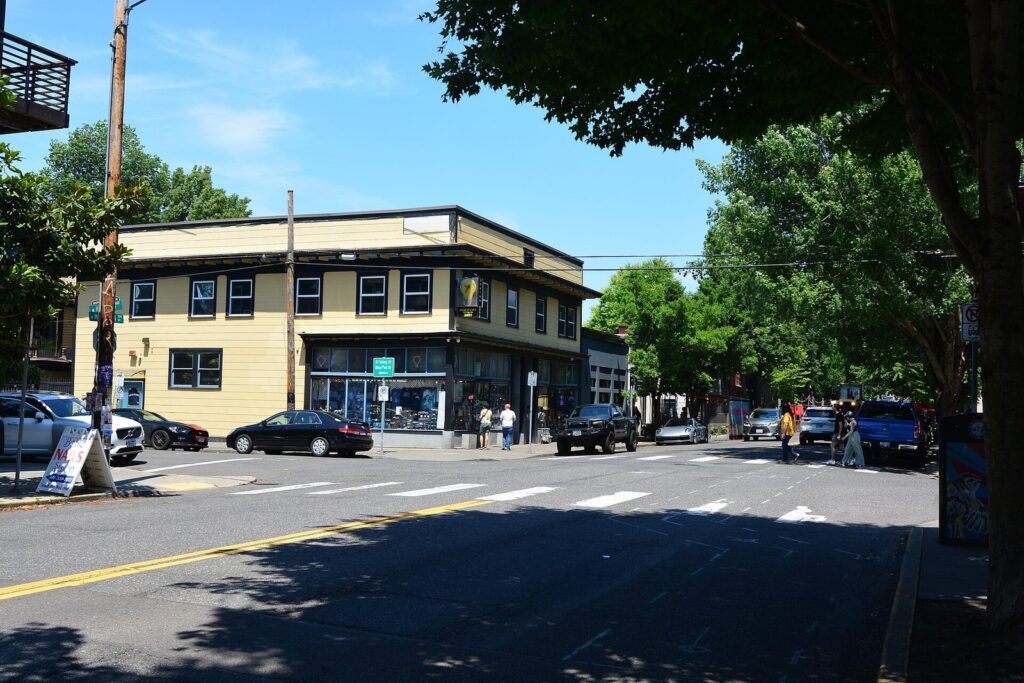
Walking loop (about 1.5-2 miles, 2 hours): from the MAX station, walk up Mississippi through its main blocks, cut east to Williams and walk back south. It pairs easily with Alberta by bus or bike for a full North and Northeast day.
Hollywood
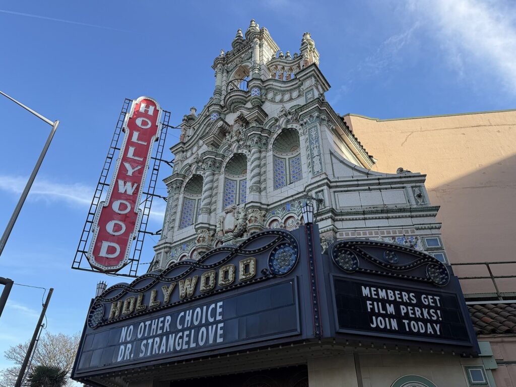
The Hollywood District takes its name from the Hollywood Theatre on NE Sandy Boulevard, a nonprofit movie palace that showed its first film in 1926 and celebrated its centennial in July 2026. It’s the reason to come: repertory screenings, festivals and a facade worth the trip. Nearby Grant Park has bronze statues of Ramona Quimby, Henry Huggins and Ribsy, the characters Beverly Cleary set in these streets. The Hollywood/NE 42nd Avenue Transit Center puts MAX Red, Blue and Green lines at the neighborhood’s edge.
St. Johns
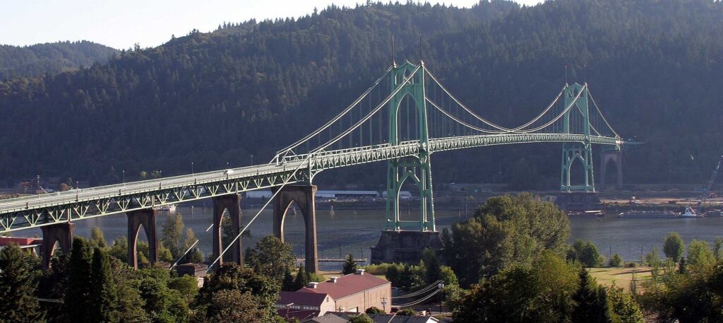
St. Johns, at the far tip of North Portland, was its own city until 1915 and still has the feel of one, with a small downtown along N Lombard Street. Below it, Cathedral Park sits under the soaring Gothic arches of the St. Johns Bridge, which opened in 1931. It’s a long way out by transit, but frequent buses reach it, and a car makes it an easy add-on to a North Portland day.
Walking loop (about 1.5 miles, 1.5 hours): start in downtown St. Johns, walk down the hill to Cathedral Park, under the bridge to the river, and back up. On the way, Kenton, on the Yellow Line, has a 31-foot Paul Bunyan statue built in 1959, a two-minute stop for anyone who likes roadside giants.
Half-day walking loops at a glance
Distances are approximate, measured along the suggested route, and times include stops. Wear shoes for rain nine months of the year.
| Loop | Start and end | Distance | Time | Highlights |
|---|---|---|---|---|
| Downtown and the waterfront | Pioneer Courthouse Square to the Burnside Bridge | About 2.5 miles | 2-3 hours | Park Blocks, art museum, PSU, Mill Ends Park |
| Old Town Chinatown | Skidmore Fountain to Union Station | About 1 mile | 2 hours with Lan Su | Chinatown Gate, Lan Su, Saturday Market |
| The Pearl | Union Station to Powell’s | About 2 miles | 2-3 hours | Tanner Springs, Jamison Park, the Fields Park |
| Nob Hill | NW 23rd and Marshall and back | About 2 miles | 2 hours | NW 23rd, NW 21st, Forest Park option |
| Central Eastside | OMSI to downtown | About 3 miles | 2-3 hours | The Esplanade, taprooms, the Hawthorne Bridge |
| Hawthorne and Division | SE 30th and Hawthorne, loop | About 3 miles | 3 hours | Vintage shops, the Bagdad, dinner |
| Alberta | NE 10th and Alberta, out and back | About 2 miles | 2 hours | Murals, galleries |
| Mississippi and Williams | Albina/Mississippi MAX station, loop | About 1.5-2 miles | 2 hours | Shops, music, bars |
| St. Johns | Downtown St. Johns, loop | About 1.5 miles | 1.5 hours | Cathedral Park, the bridge |
| Mount Tabor | Any park entrance, summit loop | About 1-2 miles | 1 hour | The summit view at sunset |
To turn loops into full days, our Portland itineraries chain them together with transit times and meal stops, keeping each day on one side of the river.
How does transit connect Portland’s neighborhoods?
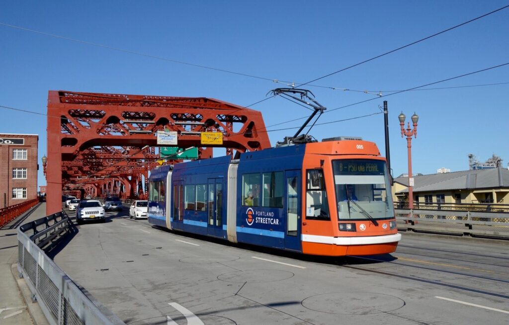
Rail covers the center and a few spokes; buses do the rest. The fare is the same everywhere: an adult TriMet fare is $2.80 for 2.5 hours, and tapping the same contactless card or phone caps your spending at $5.60 a day. The streetcar takes the same fare.
| Neighborhood | MAX | Streetcar | Frequent bus |
|---|---|---|---|
| Downtown | All five lines | NS Line, A and B Loops | Many |
| Old Town Chinatown | Red and Blue on 1st Ave; Green, Yellow and Orange on the transit mall | A few blocks west, in the Pearl | Line 20 on Burnside |
| Pearl District | Green, Yellow and Orange on its eastern edge | NS Line, A and B Loops | None needed |
| Nob Hill | None | NS Line | Line 15 |
| South Waterfront | Orange | NS Line | The Aerial Tram up the hill |
| Central Eastside | Orange (OMSI/SE Water, Clinton/SE 12th) | A and B Loops | Line 14, FX2, Line 20 pass through |
| Lloyd and Rose Quarter | Red, Blue and Green | A and B Loops | Several |
| Hawthorne | None | None | Line 14 |
| Division | None | None | FX2 |
| Sellwood | Orange (SE Tacoma/Johnson Creek) | None | Limited |
| Alberta | None | None | Line 72 on Killingsworth |
| Mississippi | Yellow (Albina/Mississippi) | None | Buses on Williams and Vancouver |
| Hollywood | Red, Blue and Green | None | Line 12 on Sandy |
| St. Johns and Kenton | Yellow (Kenton only) | None | Frequent lines to St. Johns |
TriMet adjusts routes a few times a year; its August 23, 2026 changes, for example, reworked commute-time service between Sauvie Island, St. Johns and NW 44th and Yeon. Check the trip planner the week you travel. For more on fares, the airport train and whether you need a car at all, see our Portland travel guide.
Which neighborhoods can you skip on a short trip?
Plenty of Portland is pleasant to live in and quiet to visit. On a trip of three days or fewer, you can safely skip:
- The Lloyd District, unless you have tickets at the Moda Center or a convention.
- Gateway and the airport strip, which are transit hubs and hotel clusters rather than neighborhoods to explore.
- Most of Southwest beyond downtown, whose hills and cul-de-sacs are lovely and hard to walk between.
- Outer Northeast and Southeast, except for the Jade District if you’re traveling for food.
And if your time is really short, pick one neighborhood on each side of the river rather than five across the city. A morning in the Pearl and an evening on Division beats a day spent on buses. If you haven’t chosen a base yet, our guide to where to stay in Portland matches hotels and rentals to these neighborhoods.
Portland, Oregon Neighborhoods Guide FAQ
What is the best neighborhood in Portland for tourists?
For a first visit, downtown and the Pearl District: flat, walkable, full of the main sights and served by every MAX line and the streetcar. For character, give an afternoon to Hawthorne or Alberta on the east side. Most visitors are happiest splitting time between one west side and one east side neighborhood each day.
What do NW, SE and the other prefixes mean in Portland addresses?
They’re the six sections created by the Willamette River and Burnside Street: N, NE, SE, S, SW and NW. South Portland, the S section, was added on May 1, 2020. Always include the prefix when you look up an address, since SE 12th Avenue and NE 12th Avenue are miles apart.
Which Portland neighborhood is the most walkable?
Downtown and the Pearl District, followed closely by Nob Hill. Their blocks are small, 200 feet on a side downtown, the ground is flat, and shops, parks and transit are packed together. On the east side, Hawthorne, Division, Alberta and Mississippi are walkable along their main streets, but the distances between them call for a bus or bike.
Should I visit Alberta or Mississippi?
If you have time for one, choose Alberta for murals, galleries and the Last Thursday art walk, or Mississippi for easier MAX access, live music and a more compact main street. They’re close enough to pair by bus or bike in an afternoon, with N Williams Avenue’s restaurants in between.
How do I get from downtown to Hawthorne or Division without a car?
Take TriMet’s Line 14 for Hawthorne, which runs every 15 minutes or less most of the day, or the FX2 bus for Division, every 12 minutes. Both leave from downtown and cost the standard $2.80 fare. You can also walk across the Hawthorne Bridge; Cartopia, at SE 12th, is about 25 minutes from the waterfront on foot.
Are Portland’s neighborhoods safe to walk at night?
The busy main streets (NW 23rd, the Pearl, Hawthorne, Division, Alberta and Mississippi) stay lively into the evening and are the easiest places to walk after dark. Old Town and some downtown blocks have visible street homelessness and emptier streets late at night. Use ordinary big-city sense: stick to lit, busy streets and take a rideshare for late trips home.
Related Portland Guides
- Things to Do in Portland, Oregon: the sights inside each neighborhood, with hours and prices.
- Portland, Oregon Itinerary: timed plans that link these neighborhoods day by day.
- Where to Stay in Portland, Oregon: which neighborhood to sleep in for your kind of trip.
- Best Restaurants in Portland, Oregon: where to eat in each part of the city.
- Portland, Oregon Travel Guide: seasons, fares, costs and getting in from PDX.
Sources and verification
Transit lines, schedules, event dates and hours on this page were checked on September 24, 2026 against the agencies and operators listed below. The guide is compiled from those sources and claims no first-hand visits.
- City of Portland: South Portland becomes the sixth sextant
- City of Portland: neighborhoods
- TriMet: Frequent Service lines
- TriMet: August 2026 service changes
- TriMet fares
- Portland Streetcar
- Last Thursday on Alberta
- Oaks Amusement Park
- Portland Parks & Recreation: Eastbank Esplanade
- Portland Parks & Recreation: Mill Ends Park
- Portland Parks & Recreation: Forest Park
- Portland Parks & Recreation: Springwater Corridor
- Explore Washington Park: free shuttle
- Lan Su Chinese Garden
- Portland Art Museum
- OMSI
- Portland Aerial Tram
- Portland Saturday Market
- Portland Farmers Market at PSU
Portland Tourism Guide is an independent publication, not affiliated with Travel Portland, the City of Portland or any business named here.
Photo credits
- St. Johns Bridge: photo by Unknown photographer, Wikimedia Commons (CC BY-SA 3.0)
- Pioneer Courthouse Square: photo by Steve Morgan, Wikimedia Commons (CC BY-SA 3.0)
- Chinatown Gate, Portland: photo by User:Cacophony, Wikimedia Commons (CC BY-SA 2.5)
- Powell's City of Books: photo by Michael Barera, Wikimedia Commons (CC BY-SA 4.0)
- SE Hawthorne Boulevard: photo by Gary Halvorson, Oregon State Archives, Wikimedia Commons (CC BY 4.0)
- Oaks Amusement Park entrance: photo by Tedder, Wikimedia Commons (CC BY 3.0)
- N Mississippi Avenue at Failing Street: photo by Joe Mabel, Wikimedia Commons (CC BY-SA 4.0)
- Hollywood Theatre: photo by PortlandAppraisalBlog, Wikimedia Commons (CC BY-SA 4.0)
- Portland Streetcar on the Broadway Bridge: photo by Steve Morgan, Wikimedia Commons (CC BY-SA 4.0)