The best hikes in Portland, Oregon start inside the city limits: Forest Park’s Lower Macleay Trail up Balch Creek to the Witch’s Castle and on to Pittock Mansion, the 30-mile Wildwood Trail, the 4T loop over Council Crest, and short climbs up two extinct volcanoes, Mount Tabor and Powell Butte. Most trailheads are 10 to 20 minutes from downtown, several are on MAX or a bus line, and none needs a permit or a parking pass.
This page is for visitors who want a real walk in the woods without leaving the city, and for anyone deciding which trail suits the weather, the dog or a pair of city shoes. The caveat: Portland’s trails are muddy for much of the year and storms close sections every winter, so check Portland Parks’ trail closures page before you go. Distances, rules and transit details were checked on September 24, 2026 against the park agencies’ and trail groups’ own websites.
On this page: At a glance · Compare the hikes · Forest Park · The 4T Trail · Hoyt Arboretum · Mount Tabor and Powell Butte · Tryon Creek, Marquam and Oaks Bottom · Half-day plans · By transit · After the hike · Rainy days · With dogs · With kids · Accessible trails · Mount Hood views · Seasons · Conditions and safety · What to bring · Trail rules · Beyond the city · FAQ
Portland hikes at a glance
| Question | Short answer (checked September 2026) |
|---|---|
| Best first hike | Lower Macleay Trail to the Witch’s Castle: 0.8 mile each way along a creek in Forest Park |
| Best longer hike | Continue on the Wildwood Trail to Pittock Mansion’s overlook, 2.5 more miles and about 450 feet of climbing |
| Best car-free hike | The 4T Trail: MAX, a 3.5- to 4.1-mile hike over Council Crest, the Aerial Tram and the streetcar (Monday to Saturday) |
| Easiest paved walk | Tryon Creek’s quarter-mile paved, fully accessible Trillium Trail, or the flat riverfront loop downtown |
| Best Mount Hood view | Council Crest, Pittock Mansion and Powell Butte on clear days |
| Costs | Free trails; only Washington Park’s parking ($2.40 an hour) and the tram ($9 round trip) cost money |
| Rules | Dogs on leash; no e-bikes in Forest Park; most city parks open 5 a.m. to 10 p.m. |
| Wettest months | November to January, with rain on 18 or 19 days a month on average |
For the parks themselves, including gardens, hours and admission prices, see our guide to Portland, Oregon parks and gardens. This page is about the walking: routes, distances, climbs and how to reach the trailheads.
Which Portland hike should you choose?
Portland’s in-city trails range from a paved quarter-mile loop to a 30-mile forest traverse. This table covers the ones worth crossing town for.
| Hike | Distance | Climb and surface | Best for |
|---|---|---|---|
| Lower Macleay to the Witch’s Castle | 1.6 miles round trip | Gentle; dirt path beside a creek | A first taste of Forest Park |
| Lower Macleay to Pittock Mansion | About 3.3 miles each way | Steady climb on the Wildwood Trail; dirt | A half-day hike with a city view at the top |
| Wildwood Trail sections | 30 miles in all, mile-marked | Rolling; dirt, muddy in winter | Choosing your own distance |
| Leif Erikson Drive | 11.2 miles end to end | Gentle old road; gravel, shared with bikes | Runners and rainy days |
| 4T Trail | 3.5 or 4.1 miles of walking | A 1.3-mile climb to Council Crest, then downhill | A car-free half day with a tram ride |
| Hoyt Arboretum loops | 12 miles of trails to mix | Paved, packed dirt and gravel; some stairs | Short loops among labeled trees |
| Mount Tabor loops | About 1 to 3 miles | Short climbs on a volcano; paths and roads | Sunset walks on the east side |
| Powell Butte | Loops of a few miles | Meadows and forest; shared with bikes and horses | Wide-open views east |
| Tryon Creek | 14 miles of trails | Forest ravines; one quarter-mile paved loop | Families and easy forest walks |
| Oaks Bottom | 1 mile round trip | Paved then dirt, above a wetland | Birdwatching near Sellwood |
Verdict: for one hike, do Lower Macleay to the Witch’s Castle, and keep going to Pittock if your legs and the light allow. Without a car, do the 4T on a weekday or Saturday. For a short evening walk on the east side, climb Mount Tabor.
Forest Park: the city’s big forest
Forest Park covers 5,200 acres of the West Hills with more than 80 miles of trails, and it’s open from 5 a.m. to 10 p.m. Dogs must be leashed and e-bikes aren’t allowed. It’s a working forest of Douglas fir, western red cedar and bigleaf maple rather than a manicured park, which is exactly the appeal: 15 minutes from downtown, you can walk for an hour and hear nothing but the creek.
Lower Macleay Trail and the Witch’s Castle
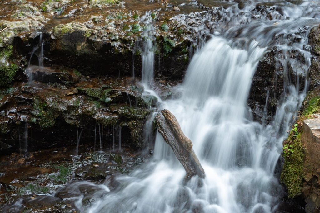
The classic first hike starts at the Lower Macleay trailhead on NW Upshur Street, which has accessible parking. The trail follows Balch Creek upstream through a steep, mossy canyon, past small cascades, for 0.8 mile to its junction with the Wildwood Trail at the Witch’s Castle, the roofless stone shell of an old park building now draped in moss and graffiti. The climb is gentle, the path is dirt and roots, and it’s the right hike for anyone who wants Forest Park in about an hour.
On to Pittock Mansion
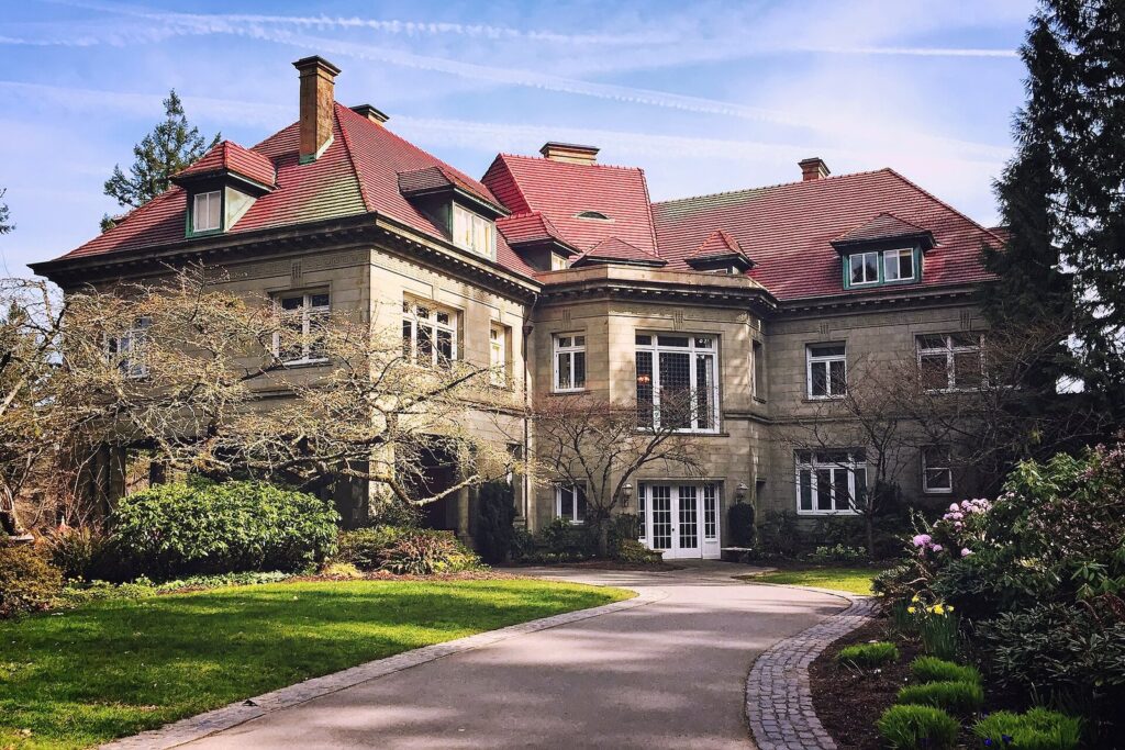
From the Witch’s Castle, turn south onto the Wildwood Trail and keep climbing. The Forest Park Conservancy puts the stretch from the junction to the Pittock Mansion overlook at 2.5 miles with nearly 450 feet of climbing, which makes the whole outing about 3.3 miles each way from the Lower Macleay trailhead. At the top, Pittock’s lawn, a public park open daily until 9 p.m., looks over downtown to as many as five Cascade peaks on a clear day. Walk back the way you came, or arrange a ride from the mansion.
The Wildwood Trail
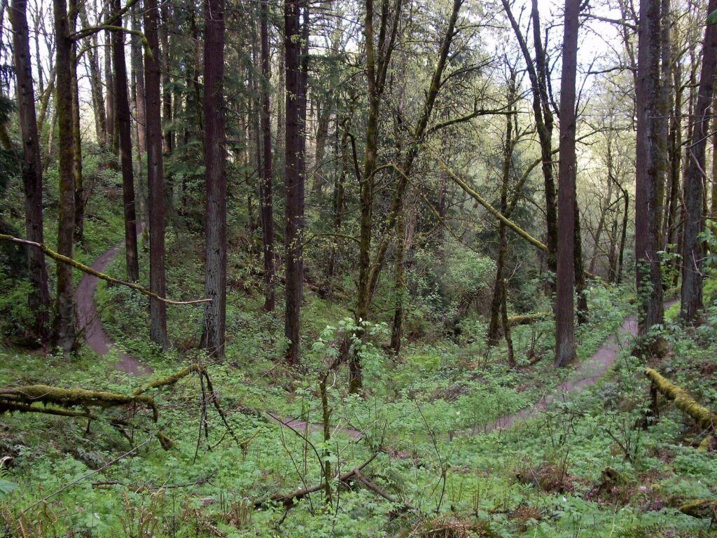
The Wildwood Trail is Forest Park’s spine: a 30-mile natural-surface footpath from the Zoo and Vietnam Veterans Memorial trailhead in Washington Park, its mile 0, north to NW Newberry Road. Blue diamond blazes mark every quarter mile, and the mile marker above each diamond tells you your distance from the zoo end, which makes it easy to plan an out-and-back of any length. The southern miles, through Washington Park and Hoyt Arboretum toward Pittock, are the busiest and the best connected to transit; the northern miles are quieter and wilder.
Which section should you walk? For a first visit, the southern end is the easiest to reach and the richest in landmarks: from Washington Park it winds through Hoyt Arboretum’s labeled trees and climbs toward Pittock Mansion. The middle miles, reached from the Lower Macleay and Thurman Street trailheads, are classic deep forest, with side trails that let you build loops back to Leif Erikson Drive. The far northern miles toward Newberry Road are the quietest in the park and best left to hikers who want solitude and have a car for the drive out.
Leif Erikson Drive
Leif Erikson Drive is an old gravel road running 11.2 miles from the NW Thurman Street trailhead to NW Germantown Road, with white concrete mileposts along the way. It’s wide, gently graded and shared with cyclists, which makes it the park’s best choice for runners, for walking side by side, and for the wettest weeks, when the gravel drains better than the dirt trails.
The 4T Trail: train, trail, tram and trolley
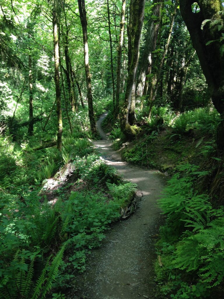
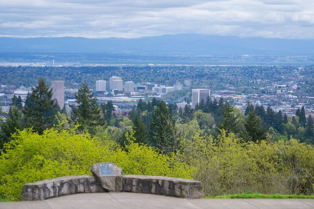
The 4T is Portland’s best car-free hike, a loop that uses four kinds of transport. Take MAX, the train, to Washington Park. Hike the trail, the Marquam Trail, 1.3 miles up through the woods to Council Crest Park, Portland’s highest point at 1,073 feet, where the view takes in downtown, the east side and, on clear days, the Cascades. From there, either follow a 2.2-mile trail down through Marquam Nature Park or take a 1.6-mile downhill route on city streets to OHSU on Marquam Hill: 3.5 or 4.1 miles of walking in all, which takes two to three hours with stops.
At OHSU, ride the Portland Aerial Tram down to South Waterfront, then catch the Portland Streetcar, the trolley, back downtown. The fares are simple. A TriMet fare costs $2.80 for 2.5 hours and caps at $5.60 a day when you tap the same card or phone, and it covers both MAX and the streetcar. The tram charges $9 for a round trip, with no one-way fares, and children 6 and under ride free with a paying adult.
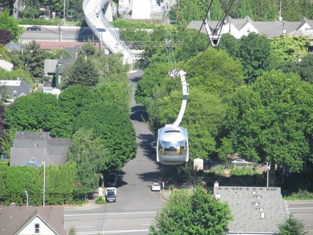
Think twice if it’s Sunday or a holiday. The tram runs weekdays from 5:30 a.m. to 9:30 p.m. and Saturdays from 9 a.m. to 5 p.m., and it’s closed on Sundays and holidays, so on those days you’d have to walk or bus down from OHSU. On Saturdays, finish before 5.
Hoyt Arboretum and Washington Park trails
Hoyt Arboretum’s 190 ridge-top acres hold 12 miles of trails, a mix of paved, packed dirt and gravel with some stairs, winding through a collection of more than 2,300 species. It’s free every day, and the Visitor Center at 4000 SW Fairview Blvd, open daily from 10 a.m. to 4 p.m., has maps for loops of any length. Because the trees are labeled, it’s the one hike in the city where you’ll come back knowing more than you started with.
The Wildwood Trail runs right through the arboretum, so you can link Hoyt with the rest of Washington Park or keep going north toward Pittock. Washington Park’s MAX station, 260 feet underground and reached by elevators, is a short walk away, and the park’s free shuttle loop connects the gardens from April through September every 15 minutes, 9:30 a.m. to 7 p.m., and every 30 minutes from 10 a.m. to 4 p.m. the rest of the year.
Mount Tabor and Powell Butte: the east side’s volcanoes
Mount Tabor is a volcanic cinder cone in Southeast Portland with three mapped loops, red, green and blue, from about one to three miles, all starting at the kiosk in the main parking lot. Trails climb through tall Douglas firs past the old reservoirs to a summit that faces west over downtown, which makes this the east side’s favorite sunset walk. The park is open from 5 a.m. to 10 p.m.; its roads close to cars all day on Wednesdays, and bicycles aren’t allowed on the green trail except on the roads.
Powell Butte Nature Park, at SE 162nd Avenue and Powell Boulevard, is another extinct volcano, much larger and wilder, with a summit meadow, an old orchard and forest on its flanks. Its trails are shared by hikers, mountain bikers and horseback riders, so keep right and listen for bells. Dogs are allowed only on leash and on the trails. The meadow is open and exposed, magnificent on a clear day and bleak in a winter wind. The standard walk climbs from the parking area by the visitor center onto the summit meadow, loops past the old orchard and the viewpoints, and returns through the forest on the butte’s flanks, a good two-hour outing that you can shorten or stretch as you like.
Tryon Creek, Marquam Nature Park and Oaks Bottom
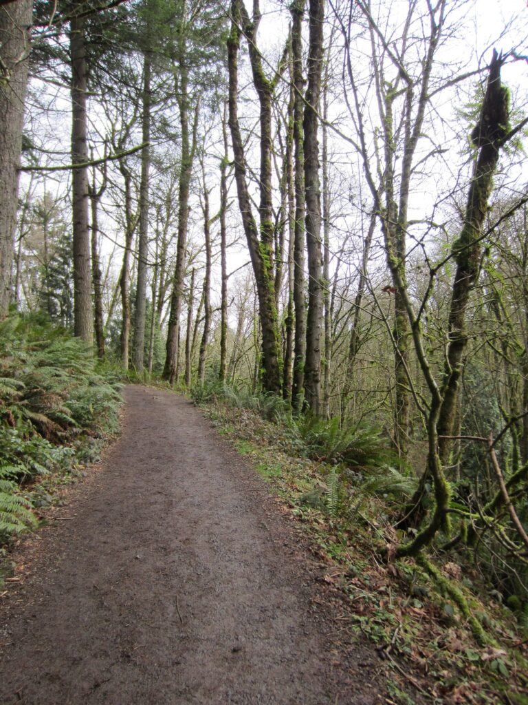
Tryon Creek State Natural Area, off SW Terwilliger Boulevard at the city’s southern edge, is a forested ravine with about 14 miles of hiking trails, 3.5 miles of horse trails that hikers can use too, and a 3-mile paved bike path. Its Trillium Trail, a quarter-mile paved and fully accessible loop near the Nature Center, is the best short forest walk in the city for wheelchairs and strollers. The Nature Center is open daily from 9 a.m. to 4 p.m., and park hours follow the daylight: 7 a.m. to 6 p.m. from November through February, stretching to 7 a.m. to 9 p.m. from May through August.
Marquam Nature Park, below Council Crest in Southwest, is the forest half of the 4T, and its trails also work as a stand-alone hike from the shelter on SW Sam Jackson Park Road. Expect steady climbing through second-growth forest, with the payoff at Council Crest’s view. Its trails climb from the canyon floor through second-growth Douglas fir and bigleaf maple, and on a weekday you may have them almost to yourself, even though downtown is barely a mile away.
Oaks Bottom Wildlife Refuge, at SE 7th Avenue and Sellwood Boulevard, is the easy one: from the north parking lot, the paved North Woodland Trail and the Oaks Bluff Trail make a one-mile round trip above a wetland full of herons and ducks. Below it runs the Springwater Corridor, a long paved rail-trail. In fall 2026 its far eastern end, between Boring Station Park and SE Haley Road, is closed on weekdays from 7 a.m. to 5 p.m. through November for construction, with a shuttle around the work zone; the sections in the city are unaffected.
Three half-day hikes that work
Each of these fits into a morning or an afternoon and ends near somewhere to eat.
1. The Forest Park classic
Start at the Lower Macleay trailhead on NW Upshur Street by 9 a.m., walk up Balch Creek to the Witch’s Castle, then climb the Wildwood Trail to Pittock Mansion’s lawn for the view. Walk back down the same way, about 6.5 miles round trip by the Forest Park Conservancy’s figures, and finish with a late brunch in Northwest Portland. If the legs protest at the Witch’s Castle, turn around there: it’s still the best hour in the park.
2. The 4T on a Saturday
Catch MAX to Washington Park around 10 a.m., hike up to Council Crest for the view, and take either the forest trail or the street route down to OHSU. Ride the tram down before it stops at 5 p.m., then take the streetcar back through the Pearl District for lunch or an early dinner. On a weekday you get the same loop with the tram running until evening.
3. An east-side evening
Walk Mount Tabor’s longest loop in the hour before sunset, finishing on the summit as the light drops behind the West Hills and downtown, then head down to Belmont or Hawthorne for dinner. On a Wednesday the park’s roads are closed to cars, so the whole climb is quiet. For more on the neighborhoods around the trailheads, see our guide to Portland, Oregon neighborhoods.
Which hikes can you reach without a car?
More than you’d expect. Washington Park station on the MAX Red and Blue lines puts you at mile 0 of the Wildwood Trail, at the start of the 4T and a short walk from Hoyt Arboretum. The 4T itself ends on the streetcar downtown. Northwest Portland’s bus lines stop within a short walk of the Lower Macleay and Leif Erikson trailheads, frequent-service buses reach the streets around Mount Tabor, and the riverfront loop starts wherever your hotel is.
TriMet changed several lines on August 23, 2026, including extending Line 15 to replace Line 16 between Sauvie Island, St. Johns and NW 44th and Yeon during weekday school and commute hours, so older trail guides may list the wrong bus. Plan with TriMet’s trip planner the day before. For fares, passes and the rest of the network, see our guide to getting around Portland, Oregon.
Where do you eat after a hike?
Every good Portland hike ends near food. The Lower Macleay and Thurman Street trailheads sit a few minutes from Northwest Portland’s cafés and brunch spots around NW 23rd Avenue, Mount Tabor is a short drive or walk from the restaurants on SE Belmont, Hawthorne and Division, and Oaks Bottom leads straight into Sellwood’s main street. After the 4T, the streetcar drops you in the Pearl District and downtown. For something quick and cheap, a food cart pod is hard to beat; our guide to Portland food carts lists the pods by neighborhood.
What are the best hikes on a rainy day?
You’ll hike in the rain here eventually, so choose trails that suit it. Forest canopy is your friend: Tryon Creek, Hoyt Arboretum and the lower Wildwood Trail stay green and sheltered in a steady drizzle, and moss-covered ravines like Balch Creek look their best wet. Leif Erikson Drive’s gravel drains better than dirt trails, which matters after a week of rain, and the paved Trillium Trail at Tryon Creek stays walkable in any weather.
Skip the viewpoints on gray days. Council Crest, Pittock and Powell Butte’s meadow all depend on the view, and in low cloud there isn’t one. Wear shoes with real grip, because roots and wooden steps turn slick, and bring a layer: November through January average 18 or 19 days of rain a month, but temperatures in the 40s mean that a waterproof shell is usually all you need.
Which Portland hikes are good for dogs?
Most of them, on a leash. Forest Park, Oaks Bottom and Powell Butte all require dogs to be leashed, and at Powell Butte they must also stay on the trail, partly because horses and mountain bikes share it. Forest Park’s wide Leif Erikson Drive is the easiest place to walk a dog without constantly stepping aside for other hikers, and Mount Tabor’s loops are popular with dog walkers on weekday evenings.
Bring water for the dog in summer, since few trails have reliable drinking fountains, and pack out what you bag. If you need an off-leash run, use one of the city’s designated off-leash areas rather than a trail.
Which hikes work for kids?
Short, varied and with a destination: that’s the formula. The Witch’s Castle is the obvious one, since a moss-covered stone ruin at the end of a creekside walk sells itself, and the 1.6-mile round trip suits most school-age children. Tryon Creek’s Nature Center and its paved Trillium Trail work for toddlers and strollers, Oaks Bottom’s one-mile loop has herons and ducks to spot, and Hoyt Arboretum’s short loops let you turn back whenever energy runs out. Save Pittock, Powell Butte and the full 4T for older kids who like a climb. Our guide to Portland, Oregon with kids has more family ideas for the rest of the day.
Which trails are accessible?
Several city trails work for wheelchairs, walkers and strollers, though conditions can change after storms:
- Tryon Creek’s Trillium Trail: a quarter-mile paved, fully accessible loop by the Nature Center, plus a 3-mile paved bike path along the park’s edge.
- Hoyt Arboretum: paved trails near the Visitor Center, among the labeled collections.
- Oaks Bottom: the paved North Woodland Trail, though it starts downhill from the parking lot.
- Forest Park: accessible parking at the Lower Macleay trailhead, though the trail itself is dirt and roots.
- The riverfront: the Eastbank Esplanade and Waterfront Park are flat and paved for their full length.
Which Portland hikes have Mount Hood views?
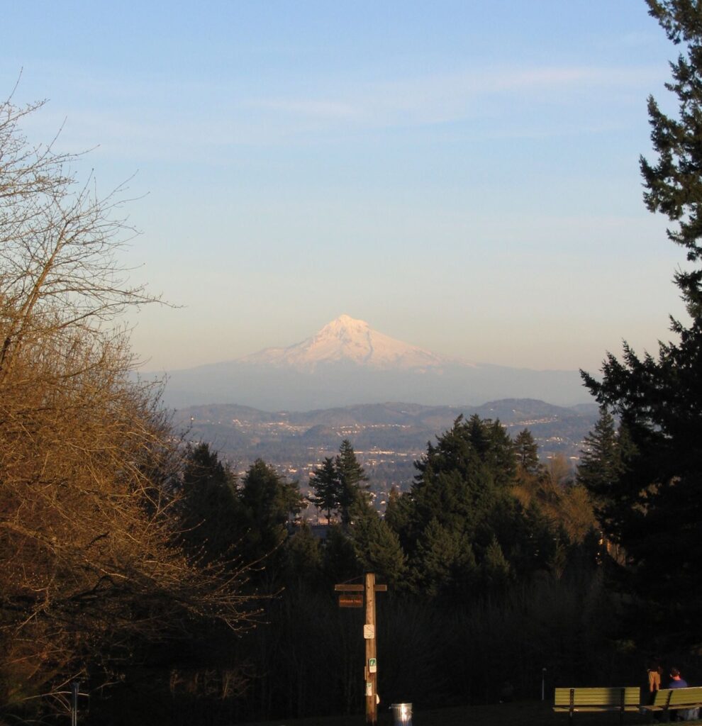
On a clear day, several city hikes end with the mountain on the horizon. Council Crest, at the top of the 4T, has the highest viewpoint in the city. Pittock Mansion’s lawn, at the top of the Lower Macleay climb, looks over downtown to as many as five Cascade peaks. Powell Butte’s summit meadow faces east toward Mount Hood with almost nothing in the way, and Mount Tabor’s summit catches it through the trees. Clear mornings from late summer into fall usually give the best views, before haze or cloud builds; in winter the mountain can hide for weeks. For the mountain itself, see our guide to Mount Hood day trips.
When is the best time to hike in Portland?
| Season | Trail conditions | Best choices |
|---|---|---|
| Winter (December to February) | Wet, muddy and cool, with occasional snow or ice and storm closures | Tryon Creek, Leif Erikson Drive, Hoyt Arboretum |
| Spring (March to May) | Showers and sunbreaks, fresh green, trilliums in the forest | Lower Macleay, Tryon Creek, the 4T |
| Summer (June to August) | Dry and warm; July and August average fewer than four rainy days | The long Wildwood sections, Powell Butte, Council Crest |
| Fall (September to November) | Cooler, clearer early on, then the rain returns | Hoyt Arboretum’s color, Mount Tabor sunsets, Pittock views |
Summer is the easiest season underfoot, but July and August afternoons can be hot on exposed ground like Powell Butte, so start early. For how the weather runs through the rest of the year, see the best time to visit Portland, Oregon.
How do you check trail conditions and stay safe?
Portland Parks posts trail closures and delays on its website, and winter storms regularly bring down trees or trigger small slides in Forest Park; the Forest Park Conservancy shares updates too. Check both before a long hike, especially after wind or heavy rain, and obey closure signs even when the trail beyond looks fine.
The rest is common sense adapted to a city forest. Carry water, a layer and a charged phone, and download a trail map, because junctions in Forest Park multiply quickly and it’s easy to take the wrong fire lane. Start long hikes early in winter, when daylight runs out by late afternoon. Trailhead parking lots at Forest Park and Washington Park are known for car break-ins, so leave nothing visible in the car. And remember that cyclists share Leif Erikson Drive and Powell Butte, while e-bikes are banned in Forest Park altogether.
What should you wear and bring?
Shoes with grip come first. Portland’s trails are dirt, roots and wooden steps, and for much of the year they’re wet, so trail runners or light hiking boots beat city sneakers by a wide margin. Bring a waterproof shell from October through May, and a warm layer year-round, since the forest stays cool even in summer. Carry water, because drinking fountains are rare on the trails, and a downloaded map; a phone light or headlamp is worth packing in winter, when it’s dark before 5 p.m. Trekking poles help on the muddy descents after a wet week. You won’t need a permit, a pass or cash for any trail in the city.
What are the trail rules and etiquette?
The rules are short. Dogs stay on leash. E-bikes are banned in Forest Park, and regular bikes are limited to the roads and fire lanes such as Leif Erikson Drive, not the footpaths. On shared trails, cyclists yield to hikers and horses, and hikers yield to horses. Stay on the trail, especially in areas under restoration, pack out everything you carry in, and step aside to let faster hikers pass on narrow sections. On Mount Tabor, keep bikes off the green trail.
What about hikes outside the city?
Portland’s in-city trails are the easiest to reach, but the bigger hikes are an hour or two away. The Columbia River Gorge has waterfall trails from short strolls to steep climbs; our guide to waterfalls near Portland, Oregon covers which Gorge trails are open and which are closed in 2026. Mount Hood adds alpine lakes and wilderness loops in summer. Those trails follow different rules, including timed permits, forest passes and wilderness permits, so read up before you go.
Portland Hikes FAQ
What is the best hike in Portland for first-time visitors?
The Lower Macleay Trail in Forest Park. It follows Balch Creek for 0.8 mile to the Witch’s Castle with only a gentle climb, it’s 15 minutes from downtown, and it shows you the scale of the forest in an hour. If you want more, continue up the Wildwood Trail to Pittock Mansion for the view.
Do you need a permit or pass to hike in Portland?
No. The city’s parks and Forest Park charge nothing to hike, and no trail in the city needs a permit. You’ll pay only for parking in Washington Park, $2.40 an hour, and for the Aerial Tram if you do the 4T. Permits and passes come into play only on trails in the Gorge and on Mount Hood.
Can you hike in Portland without a car?
Easily. MAX goes straight to Washington Park for the Wildwood Trail, Hoyt Arboretum and the 4T, and buses serve the Lower Macleay and Leif Erikson trailheads in Northwest Portland. TriMet’s fare caps at $5.60 a day, so a hike and a return trip cost no more than a coffee.
How long is the Wildwood Trail?
Thirty miles, from the Zoo and Vietnam Veterans Memorial trailhead in Washington Park north to NW Newberry Road. Few people hike it in one go; most walk a section and turn around. Blue diamond blazes every quarter mile, with mile markers above them, tell you exactly how far you’ve come from the zoo end.
Can you bike in Forest Park?
Only on the roads and fire lanes, such as Leif Erikson Drive, which cyclists share with hikers and runners. The footpaths, including the Wildwood Trail, are for walkers only, and e-bikes aren’t allowed anywhere in the park. Powell Butte, by contrast, has trails shared by hikers, mountain bikers and horseback riders.
Is Forest Park safe for solo hikers?
It’s busy near the main trailheads, especially on weekends, and the popular stretches of the Lower Macleay and Wildwood trails rarely feel lonely. Use common sense: tell someone your route, carry a phone and a map, turn back before dark, and don’t leave valuables in the car at the trailhead.
What is the easiest hike in Portland?
Tryon Creek’s Trillium Trail, a quarter-mile paved loop that’s fully accessible, or Oaks Bottom’s one-mile round trip from the north parking lot. The flat riverfront loop on the Eastbank Esplanade and Waterfront Park is easy too, though it’s more stroll than hike.
Related Portland Guides
- Portland, Oregon Parks and Gardens: the gardens, hours and prices behind the trailheads
- Waterfalls Near Portland, Oregon: Gorge trails, closures and permits in 2026
- Mount Hood Day Trips from Portland: alpine lakes, waterfall hikes and wilderness permits
- Getting Around Portland, Oregon: MAX, streetcar, tram and bus fares
- Things to Do in Portland, Oregon: what to pair with a morning on the trails
Sources and verification
Details on this page were checked on September 24, 2026 against the agencies and organizations listed below. The page is compiled from their published information and claims no first-hand visits.
- Portland Parks and Recreation: Forest Park
- Portland Parks and Recreation: trail closures and delays
- Forest Park Conservancy: Lower Macleay Trail
- Forest Park Conservancy: trails information
- The 4T Trail: Zoo to OHSU by trail
- Portland Aerial Tram: fares and hours
- TriMet: fares
- TriMet: August 2026 service changes
- Hoyt Arboretum: plan your visit
- Explore Washington Park: free shuttle
- Friends of Mt. Tabor Park: maps
- Portland Parks and Recreation: Mt. Tabor Park
- Portland Parks and Recreation: Powell Butte Nature Park
- Portland Parks and Recreation: Oaks Bottom Wildlife Refuge
- Oregon State Parks: Tryon Creek State Natural Area
- Pittock Mansion: visit
Portland Tourism Guide is an independent publication, not affiliated with Travel Portland, the City of Portland or any business named here.
Photo credits
- Portland from Council Crest: photo by Visitor7, Wikimedia Commons (CC BY-SA 3.0)
- Balch Creek, Lower Macleay Trail: photo by Gary Halvorson, Oregon State Archives, Wikimedia Commons (CC BY 4.0)
- Pittock Mansion: photo by Steven Pavlov, Wikimedia Commons (CC BY-SA 4.0)
- Wildwood Trail: photo by EncMstr, Wikimedia Commons (CC BY-SA 3.0)
- Marquam Nature Park: photo by Emanresupdx, Wikimedia Commons (CC BY-SA 3.0)
- Portland Aerial Tram: photo by Doug Kerr from Albany, NY, United States, Wikimedia Commons (CC BY-SA 2.0)
- Tryon Creek State Natural Area: photo by Another Believer, Wikimedia Commons (CC BY-SA 3.0)
- Mount Hood from Council Crest: photo by Jenn, Wikimedia Commons (CC BY 2.0)