The best Oregon Coast day trips from Portland head to the North Coast, where Cannon Beach, Seaside and Astoria sit about 1.5 to 2 hours from downtown. Go to Cannon Beach and Ecola State Park for sea stacks and tide pools, Astoria for history or a wet forecast, Seaside when the kids set the agenda, and Tillamook and Pacific City for cheese, capes and a sand dune you’re allowed to climb. Plan around the tide rather than the clock and you’ll see more than most visitors do.
This page is for travelers based in Portland, Oregon who want a day or a night at the ocean, with or without a car. The caveat that matters most: the Pacific here is cold and unpredictable, and coast weather often has nothing to do with the city’s, so pack a jacket even in August and check the tide table before you set a departure time. Everything below was checked on September 24, 2026 against the operators’ and agencies’ own websites.
On this page: At a glance · Choosing a town · Drive times and routes · Cannon Beach · Ecola · Seaside · Astoria · Manzanita · Tillamook · Pacific City · Sample days · Tides · Safety · Seasons · Parking permits · Without a car · Staying overnight · FAQ
Oregon Coast day trips at a glance
| Question | Short answer (checked September 2026) |
|---|---|
| Closest classic beach town | Cannon Beach, about 80 miles and 1.5 hours west on US 26; Seaside is next door |
| Time needed | A full day: 3 to 4 hours of driving round trip leaves 5 to 7 hours at the coast |
| Main costs | Fuel, food and, at many state parks, a parking permit: $10 a day for Oregon residents, $12 for visitors |
| Best months | July to September for the driest days; April to early July for puffins; winter for storm watching |
| Tide pools | Arrive about an hour before low tide; the lowest daytime tides fall on spring and summer mornings |
| Rain plan | Astoria’s maritime museum and forts, or the Tillamook Creamery |
| Without a car | Possible, on the POINT NorthWest and Wave buses from Union Station |
| Book ahead? | Nothing for a day trip; beach lodging on summer weekends goes early |
Still choosing between the ocean, the Columbia River Gorge, Mount Hood and wine country? Our comparison of day trips from Portland sets them side by side. This page starts once you’ve picked salt water.
Which part of the coast should you pick?
From Portland, only the northern end of Oregon’s long coastline makes an easy day. Draw a line from Astoria, at the mouth of the Columbia River, south to Pacific City: every town inside it is roughly two hours from downtown or less, and each one does something the others don’t.
The classic mistake is trying to see all of it. US 101 is two lanes with slow town stretches every few miles, and a four-town day is mostly windshield. Pick one anchor, add one nearby stop, and save the rest.
| If you want | Go to | Why it works | Think twice if |
|---|---|---|---|
| The classic postcard | Cannon Beach and Ecola State Park | Haystack Rock, tide pools at its base, headland viewpoints just north of town | You hate crowds; sunny summer Saturdays are packed |
| History, and a plan B for rain | Astoria and Fort Stevens | A maritime museum, the Astoria Column, a shipwreck on the beach, Lewis and Clark’s winter fort | You mainly want to sit on sand |
| Easy beach time with kids | Seaside | A flat, wide beach, the paved Prom, arcades and a small aquarium | You’re after quiet or big scenery |
| A long, quiet beach walk | Manzanita | Wide sand below Neahkahnie Mountain and a small village | You need attractions to fill the day |
| Cheese, a lighthouse and capes | Tillamook and the Three Capes | The Tillamook Creamery, Cape Meares, Oceanside and the Cape Lookout trail | You get carsick; OR 6 and the capes road are all curves |
| A dune and a sunset | Pacific City | The Cape Kiwanda dune, dory boats launched off the beach, a second Haystack Rock | You want the shortest possible drive |
Lincoln City, just south of that line, is the stretch option, reached on OR 18 past Grand Ronde, home of the Confederated Tribes of Grand Ronde. For a single day the North Coast gives you more variety for the same drive, so save Lincoln City and Newport’s Oregon Coast Aquarium for a night on the central coast.
Verdict: for a first visit, do Cannon Beach and Ecola, the shortest drive to the coast’s best-known scenery. Choose Astoria when the forecast is wet, Seaside when the kids get a vote, and Pacific City once you’ve done Cannon Beach.
How long is the drive, and which road is best?
Four main roads cross the Coast Range, each landing on a different stretch of shore. Go out on one and back on another.
| Destination | Main route from Portland | Typical drive from downtown | Worth knowing |
|---|---|---|---|
| Cannon Beach | US 26 west, then US 101 south | About 1.5 hours, 80 miles | The easiest classic target |
| Seaside | US 26 west, then US 101 north | 1.5 to 2 hours; the town’s site says 90 miles and 2 hours | Flat, wide beach and the Prom |
| Astoria | US 30 along the Columbia | About 2 hours | Come home on US 26 for a loop |
| Manzanita | US 26, then US 101 south past Cannon Beach | Roughly 2 hours | The last stretch climbs around Neahkahnie Mountain |
| Tillamook | US 26 to Banks, then OR 6 | About 90 minutes | Curvy, with thin services in the forest |
| Pacific City | OR 6 through Tillamook, or OR 18 and US 101 | Roughly 2 hours | Loop out one way and back the other |
| Lincoln City | OR 99W and OR 18 | Roughly 2 hours | Slow through the wine-country towns in summer |
Those times assume no traffic and no stops, so check a live map on the day. On summer weekends, westbound traffic builds on Friday afternoons and Saturday mornings, and the Sunday-afternoon return can add an hour. Leave before 8 a.m. and head home before 3 p.m. or after sunset.
US 26, the Sunset Highway
The fastest way to salt water. US 26 heads west past Beaverton, narrows to mostly two lanes in the Coast Range, and meets US 101 between Seaside and Cannon Beach; Seaside’s visitor site counts 75 miles from Portland to that junction. There are a few passing lanes, but on a busy day the slowest motorhome sets the pace.
US 30 along the Columbia
US 30 follows the river through St. Helens, Rainier and Clatskanie to Astoria in about two hours. It’s flatter and slower than US 26, with river views and freight traffic.
OR 6, the Wilson River Highway
OR 6 leaves US 26 near Banks and winds through the Tillamook State Forest to Tillamook, about 90 minutes from Portland by Visit Tillamook Coast’s count. The forest grew back after the Tillamook Burn, a run of wildfires between 1933 and 1951, and was replanted partly by Oregon schoolchildren. Services are thin and the curves constant, so fill the tank first and give the front seat to anyone prone to carsickness.
Two notes for drivers. In Portland an attendant may still pump your gas, but a 2023 law lets drivers pump their own at any station at any hour in 20 rural counties, including Clatsop and Tillamook. And from November through March, check ODOT’s TripCheck before you leave: the Coast Range passes on US 26 and OR 6 can ice over, and storms bring trees down across the road.
Cannon Beach and Haystack Rock
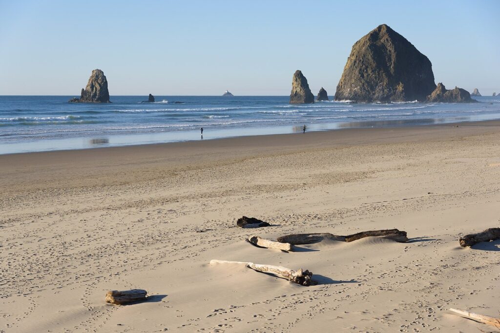
Cannon Beach is the default for good reasons. It’s the closest classic beach town, the beach is wide and miles long, and Haystack Rock stands right on the sand. The small, walkable town runs along Hemlock Street with galleries, bakeries and cafés, and Ecola State Park and Hug Point sit just north and south of it.
Haystack Rock is protected twice over. Its intertidal zone is one of Oregon’s seven Marine Gardens, and everything above the high-tide line belongs to the Oregon Islands National Wildlife Refuge. You can walk around the base and peer into the pools, but you may not climb above the barnacle line or take any animal, shell or rock from within 300 yards of it. The city’s Haystack Rock Awareness Program, running since the mid-1980s, sets up at the rock during daytime low tides from mid-February to late October, with sea life on display and people on hand to explain it.
Tufted puffins arrive in late March or early April and leave around the end of August, and they’re easiest to see from April through early July, when they’re busy at burrows on the rock’s grassy upper slopes. It’s the most accessible tufted puffin colony in the Northwest, which still means binoculars.
Hug Point, a few minutes south on US 101, is the other stop worth your time. Stagecoaches once had to hug the rock at low tide to get around the point, and the road cut into the sandstone for them is still there, along with a small waterfall that drops onto the beach and a couple of shallow caves. All of it is reachable only as the tide goes out, so go on a falling tide.
Think twice if your only free day is a sunny Saturday in August. Downtown parking fills by late morning and the sand around Haystack Rock feels like a street fair. Go on a weekday, arrive before 10 a.m., or start at Tolovana, the quieter south end, and walk north.
Ecola State Park and Indian Beach
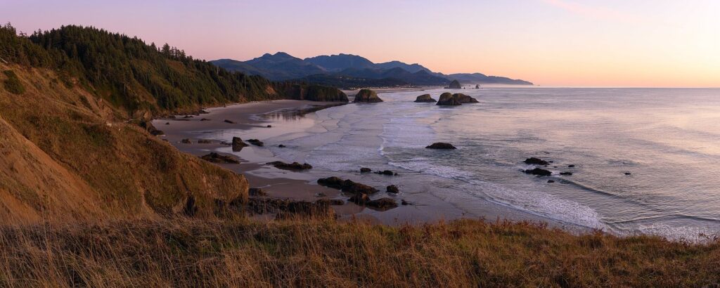
Ecola is where many of the classic Cannon Beach photographs are taken. From Ecola Point you look south across Crescent Beach to Haystack Rock, with headlands stacked toward Neahkahnie Mountain on a clear day, and offshore sits Tillamook Rock Lighthouse, decommissioned in 1957 and still known as Terrible Tilly. A winding road through spruce forest climbs to it from the north end of Cannon Beach.
Farther along, Indian Beach is a small cove with tide pools and surfers most of the year. The Clatsop Loop Trail climbs from there onto Tillamook Head along the route William Clark’s party took in January 1806 to reach a beached whale, which Tillamook people were already rendering when Clark arrived to bargain for blubber and oil. The park’s name comes from ekoli, the Chinook Jargon word for whale. The North Coast is the homeland of the Clatsop, Nehalem and Tillamook peoples, whose descendants are part of tribal communities here today.
Ecola requires the state day-use parking permit: $10 for Oregon residents and $12 for visitors, from the fee machine, the posted QR code or online. Both lots are small and fill on sunny weekends, so come early or late, and check the park’s alerts first, since storms and slides can close coastal roads and trails.
Verdict: the best hour you can spend on the North Coast, as long as you beat the crowds to the lot.
Seaside: the easy family beach
Seaside is Oregon’s old-fashioned resort town, and it doesn’t pretend otherwise. Broadway runs past arcades, candy shops and souvenir stores to the Turnaround, where a statue marks the end of the Lewis and Clark Trail, and the Prom, a paved walkway above the beach, runs off in both directions. The beach is broad, flat and easy for small children.
Families come for the sand, the Prom for bikes and strollers, and the small Seaside Aquarium, where feeding the harbor seals is the highlight. Near the south end of the Prom, the salt works where members of the expedition boiled seawater through the winter of 1805-06 is part of Lewis and Clark National Historical Park. The Tillamook Head trail also starts here, a real hike over the headland to Indian Beach.
Think twice if you want scenery more than amenities, since Haystack Rock, Ecola and Hug Point are all south of town. Plenty of families do sand and arcades in Seaside, then drive south for sunset at Cannon Beach. For the city side of a family trip, see our guide to Portland, Oregon with kids.
Astoria and the mouth of the Columbia
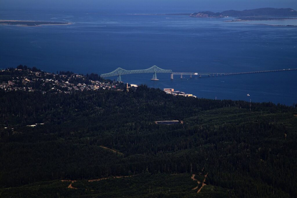
Astoria is the North Coast’s history town and its best bet in bad weather. It grew from John Jacob Astor’s fur-trading post of 1811, climbs a steep hill of Victorian houses, and looks out at the Astoria-Megler Bridge, which runs more than four miles across the Columbia to Washington. It isn’t a beach town, and on a stormy day that’s the point.
Start at the Columbia River Maritime Museum on the waterfront. It tells the story of the Columbia River Bar, one of the most dangerous river entrances in the world, and of the pilots and Coast Guard crews who work it, and the lightship Columbia moored outside is part of the visit. Then walk the Riverwalk past old cannery piers, where sea lions haul out and complain loudly about everything.
For the view, drive up Coxcomb Hill to the Astoria Column, a 1926 tower wrapped in a spiral frieze of local history. The hilltop panorama is worth it even without climbing the stairs, and the Friends of Astoria Column post current hours and parking details. Fans of The Goonies (1985) will find the old county jail from its opening, now the Oregon Film Museum; the house from the film is private, so look from the street.
Fort Stevens and Fort Clatsop
Fort Stevens State Park guarded the river mouth from the Civil War era through World War II, and its concrete gun batteries are open to wander. On its beach, the rusted bow of the Peter Iredale, a British sailing ship that ran aground in 1906, still pokes out of the sand. The park requires the state parking permit.
Fort Clatsop, in Lewis and Clark National Historical Park, is a replica of the log fort where the Corps of Discovery spent the wet winter of 1805-06. The National Park Service charges an entrance fee; check current rates and hours before you go.
Verdict: the best rainy-day coast trip from Portland, and a good one in any weather. Add Fort Stevens for the shipwreck, or Cannon Beach, about 25 miles south on US 101, for a sunset on the way home.
Manzanita, Oswald West and Nehalem Bay
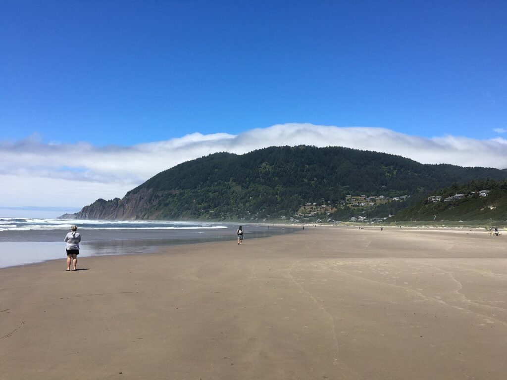
South of Cannon Beach, US 101 climbs onto the cliffs of Neahkahnie Mountain, with pullouts high above the surf, then drops into Manzanita: a few quiet blocks of cafés and shops above a long, wide beach. If Cannon Beach is where you go to see the coast, Manzanita is where you go to walk it.
Nehalem Bay State Park fills the sand spit south of town and requires the state parking permit. The Neahkahnie Mountain trail, just off US 101, is the workout: a steep forest climb to a summit view down the coast, worth every step on a clear day and pointless in fog. On the way from Cannon Beach, Oswald West State Park has a forest trail from the highway to Short Sand Beach, a sheltered surfers’ cove; its roadside lots are small and trails change after storms, so check the park page first.
Think twice if you need a list of attractions to fill the day. Manzanita rewards a slow walk, or a night in town.
Tillamook and the Three Capes
Tillamook is dairy country, and most day-trippers come for one building: the Tillamook Creamery visitor center on US 101 at the north end of town, where a viewing gallery overlooks the packaging lines and the ice cream counter draws a line on summer afternoons. Go early, and check hours, which change with the season.
The better reason to come is west of town. The Three Capes Scenic Route loops along the ocean between Tillamook and Pacific City. Cape Meares has a stubby lighthouse and the Octopus Tree, a Sitka spruce whose limbs branch like a candelabra. Oceanside is a small village facing Three Arch Rocks, a national wildlife refuge offshore. Cape Lookout State Park’s trail runs out along the spine of the cape to a viewpoint high above the water, one of the best places on this coast to watch gray whales in winter and spring.
Since March 30, 2026, Cape Meares and Oceanside Beach require the state parking permit. The capes road is narrow and prone to slides, and parts of the route have been closed or rerouted before, so check TripCheck and Tillamook County’s road notices on the day.
Pacific City and Cape Kiwanda
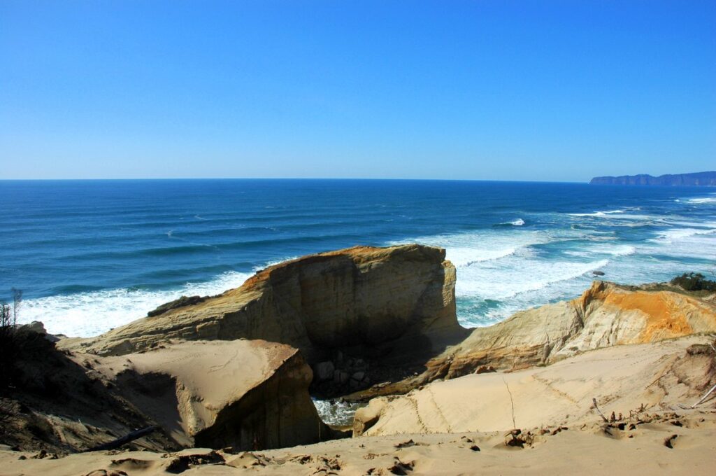
Pacific City, at the south end of the capes route, has the most unusual beach scene on this stretch of coast. Cape Kiwanda is a sandstone headland with a huge dune piled against its side; people climb it for the view, run down it for fun and sit on top at sunset. Pacific City’s own Haystack Rock, taller than Cannon Beach’s, stands offshore, and on calm mornings the dory fleet launches its flat-bottomed fishing boats straight off the beach into the surf.
Stay behind the fences on the cape. The sandstone beyond them is undercut, and falls there have been fatal. Bob Straub State Park, on the spit south of town, is the quieter beach and has required the state parking permit since March 30, 2026.
Verdict: the best second coast trip, with a sunset to match. Pair it with the Three Capes and come home on OR 18.
Three day trips that work
Each fits between an 8 a.m. start and an evening return. Look up the day’s low tide first and build around it.
1. The classic: Ecola, Haystack Rock and Hug Point
Take US 26 straight to Ecola while the lots are empty, then drive on to Indian Beach. In Cannon Beach, park once and walk: Haystack Rock at low tide, lunch on Hemlock Street, galleries after. Finish at Hug Point’s waterfall if the tide is still low, or stay for the late light on Haystack Rock.
2. The history loop: Astoria out, Cannon Beach back
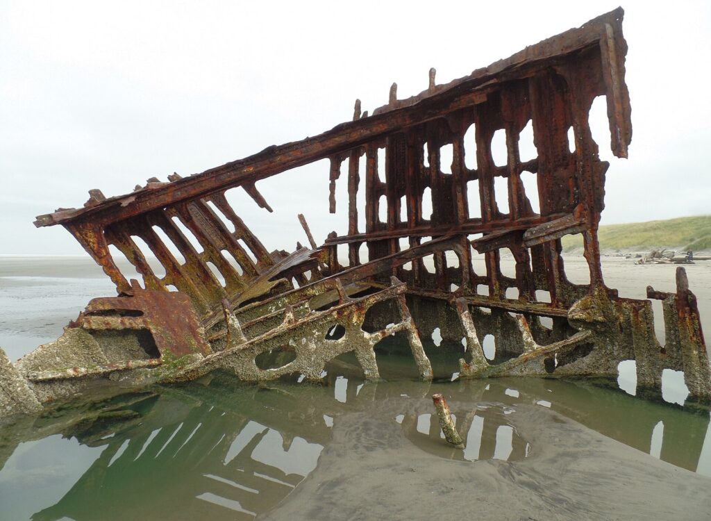
Drive US 30 to Astoria for the maritime museum at opening time, then lunch on the waterfront, the Astoria Column, and Fort Stevens for the batteries and the Peter Iredale. Head south through Seaside for a walk on the Prom, catch sunset at Cannon Beach and take US 26 home. It’s a long day, but you never repeat a road.
3. Cheese and capes: Tillamook to Pacific City
Take OR 6 to the creamery before the lines, then follow the Three Capes: Cape Meares, Oceanside, and the Cape Lookout trail if you have two or three hours and the legs for it. End on the Cape Kiwanda dune at sunset and drive home on US 101 and OR 18.
If the coast is one day of a longer stay, our Portland itineraries show where it fits, usually on the day with the kindest forecast.
When should you go to the tide pools?
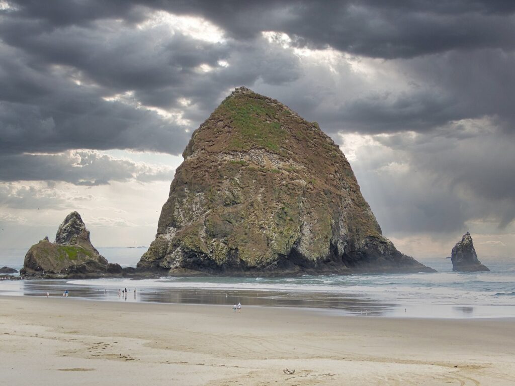
Tide pools only appear when the water goes out, so the tide table runs your day. The Oregon Coast gets two high tides and two low tides roughly every 25 hours, and the two lows are rarely equal. You want the lower low, ideally a minus tide, when the water drops below the average low mark and uncovers rock that is usually underwater. Check NOAA’s tide predictions for the nearest station and arrive about an hour before low tide.
The lowest daytime tides come on mornings from late spring into summer, which is why a June weekday at 7 a.m. can beat any August afternoon for sea stars and anemones. Winter has deep lows too, but many of them fall after dark.
The etiquette is simple: walk on bare rock or sand rather than on mussels and barnacles, look without prying anything loose, and take nothing home. Good pools within day-trip range include Haystack Rock, Indian Beach, Hug Point and the rocks at Oceanside.
How do you stay safe on the Oregon Coast?
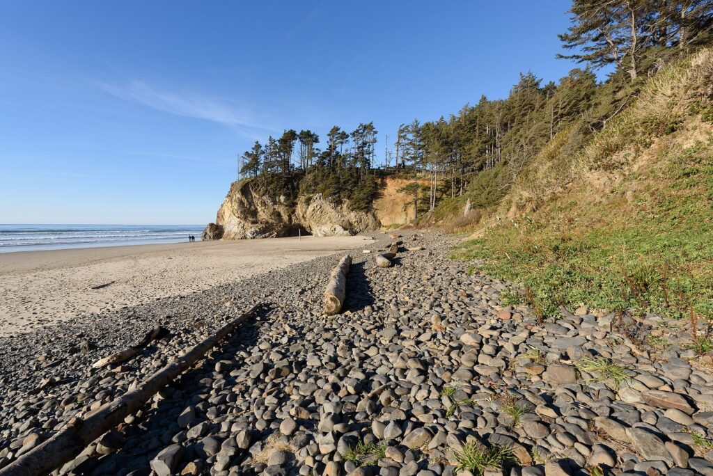
The Oregon Coast looks gentle on a calm day and isn’t. Its dangers mostly catch people who never planned to get wet.
| Hazard | What happens | What to do |
|---|---|---|
| Sneaker waves | One wave runs far higher up the beach than the rest, without warning; most common from fall through spring | Never turn your back on the ocean; stay well above the wet sand when the surf is up |
| Rolling logs | Surf lifts and rolls beach logs that weigh tons | Stay off logs on wet sand or in the surf, and keep children off them |
| Incoming tide | Water cuts off points, coves and the base of sea stacks | Check the tide table; round points only on a falling tide |
| Rip currents | Narrow currents pull swimmers straight out, and most beaches have no lifeguards | Swim parallel to shore to escape one; better still, just wade |
| Cold water | The Pacific here is cold all year, and cold shock can hit strong swimmers | Wetsuits for surfing; keep children to ankle depth |
| Cliffs and dunes | Sandstone and bluff edges crumble without warning | Stay behind fences and well back from edges |
| Tsunami | A strong offshore earthquake can send waves ashore within minutes | Learn the blue evacuation-route signs; after strong or long shaking, walk to high ground at once |
The National Weather Service office in Portland issues Beach Hazards Statements when sneaker waves or big surf are expected, so check its coastal forecast the evening before. A statement doesn’t close the beach. It means stay farther back than feels necessary and keep dogs and children close.
At Hug Point, around Haystack Rock and in the coves at Ecola and Short Sand, a rising tide can close the way back while you’re still exploring. If you’re cut off, don’t try to wade around a point through the surf: climb above the high-tide line and wait, or call 911.
What is the coast like in each season?
The coast makes its own weather. A hot day in Portland often means fog at the beach, because heat inland pulls cool marine air ashore, and a gray morning in the city can clear at the coast by noon. Pack layers in every season and check the coastal forecast, not Portland’s.
| Season | What to expect | Best for | Watch for |
|---|---|---|---|
| Summer (June to August) | The driest months, with morning fog and windy afternoons | Minus-tide mornings, puffins until early July, long evenings | Weekend crowds and parking, cold water |
| Fall (September and October) | Often the best mix: clearer days, calm spells, fewer people | Beach walks, Astoria, quiet weekends | The first big storms and sneaker waves by late October |
| Winter (November to February) | Storms, rain, high surf and the year’s king tides | Storm watching from a safe spot, gray whales heading south | Ice on US 26 and OR 6, downed trees, sneaker waves |
| Spring (March to May) | Showers and sunbreaks, still-cold water | Gray whales heading north, puffins returning | Wind and fast-changing forecasts |
Gray whales pass twice a year, southbound with a peak around the end of December and northbound with a peak in late March; Ecola, Cape Meares and Cape Lookout are the North Coast’s best viewpoints, and Oregon State Parks usually posts volunteers at headlands around the peaks. For the city side of the calendar, see the best time to visit Portland, Oregon.
What to do at the coast when it rains
Rain rarely cancels a coast day, but it changes the plan: Astoria’s museum and forts, the Tillamook Creamery, Cannon Beach’s galleries, or a Pacific storm watched from a café window. If high-wind or high-surf warnings join the rain, choose the Columbia River Gorge’s waterfalls instead and save the ocean for a calmer day.
Where do you need a parking permit?
Oregon State Parks charges a day-use parking fee at a growing list of its parks, and on March 30, 2026 it added 22 more, several of them on the coast. The daily permit is $10 for Oregon residents and $12 for out-of-state visitors; a 12-month permit, $60 or $75, pays for itself after about six days of use. Buy it online, from the fee machine in the lot or by the posted QR code.
| Place | Parking in 2026 | Notes |
|---|---|---|
| Ecola, Fort Stevens and Nehalem Bay state parks | State day-use permit | Small lots at Ecola; the Peter Iredale is inside Fort Stevens |
| Cape Meares, Oceanside Beach, Bob Straub, Roads End and Devil’s Punchbowl | State day-use permit since March 30, 2026 | The Three Capes, Pacific City, Lincoln City and Otter Rock |
| Fort Clatsop | National Park Service entrance fee | Check current rates with the park |
| Town streets and lots | Each city’s posted rules | Time limits differ from town to town |
The state fee doesn’t apply if you arrive on foot, by bike or by public transit, or if you display a state parks camping hangtag or a 12- or 24-month permit. A permit doesn’t create a parking space, though: on sunny weekends the small lots fill regardless.
Can you reach the coast without a car?
Yes, if you plan it like a train trip rather than a road trip. Two bus services leave from Union Station, Portland’s Amtrak station in Old Town.
POINT NorthWest, part of the state’s intercity bus network, runs every day, holidays included, between Union Station and Astoria along US 26 and US 101, stopping at 10 communities including Cannon Beach. With two buses a day in each direction, a same-day return leaves limited beach time, so check the current timetable; tickets are sold through Amtrak and local agents.
The Wave, run by the Tillamook County Transportation District, links Union Station with Tillamook, and its routes continue along US 101 with stops between Cannon Beach and Lincoln City. Visit Tillamook Coast lists the adult fare at $15 one way or $120 for a 10-trip pass, with children 5 to 11 at half fare and the first child under 5 free. Schedules are on NW Connector, the shared route map for the region’s rural transit districts.
One perk of going car-free: the state parks parking fee doesn’t apply to transit riders. Guided tours from Portland also run to the North Coast; compare how long you’d actually spend at the beach. To reach Union Station by MAX, streetcar or bus, see our guide to getting around Portland, Oregon.
Day trip or overnight?
A day trip trades three to four hours in the car for five to seven at the ocean, a fair deal for Cannon Beach or Seaside. It gets worse the farther you go, and in summer the best light arrives in the evening, just when a day-tripper has to leave.
If you stay, book early for summer weekends and holidays, when beachfront rooms go first. Prices rise with ocean views, weekends and summer dates, and midweek in fall is when the same room costs least. Oregon has no sales tax, but its state lodging tax is 1.5% on stays that end by December 31, 2026 and 2.75% on stays ending on or after January 1, 2027, and coastal cities and counties add their own lodging taxes on top.
Verdict: one coast day works; one night is better. If Portland stays your base, our guide to where to stay in Portland, Oregon covers the city side, and things to do in Portland, Oregon fills the days you’re not at the beach.
Oregon Coast Day Trip FAQ
Is the Oregon Coast worth a day trip from Portland?
Yes, if you stick to the North Coast and keep the plan small. Cannon Beach is about 1.5 hours away, which leaves most of the day for Ecola’s viewpoints, Haystack Rock and a long walk on the sand. It stops being worth it when you add three more towns, or when a storm warning is posted for the coast.
What is the closest ocean beach to Portland?
Cannon Beach and Seaside, on either side of the junction of US 26 and US 101, at roughly 80 to 90 miles. The beaches on Sauvie Island are far closer, but they’re on the Columbia rather than the ocean, and their parking rules and permits change by season.
Can you swim in the ocean in Oregon?
You can, but few people do. The water is cold all year, rip currents are common and most beaches have no lifeguards; local surfers wear full wetsuits for good reason. Wading on a calm day is fine if you watch the waves and stay out of the surf zone.
When is the best time to see puffins at Haystack Rock?
April through early July, while the birds are settling into burrows and raising chicks; they arrive in late March or early April and leave around the end of August. Bring binoculars, scan the grassy upper slopes rather than the rocky base, and look for the Haystack Rock Awareness Program on the beach at low tide.
Is it safe to drive to the coast from Portland in winter?
Usually, with preparation. US 26 and OR 6 cross the Coast Range, where snow and ice are possible from November into March and storms can drop trees across the road. Carry chains or traction tires, drive in daylight, check TripCheck in both directions, and postpone if a high-wind warning is posted.
Can you do the coast and the Gorge or Mount Hood in one day?
Not sensibly. The coast is west of Portland while the Gorge and Mount Hood are east, so combining them means crossing the metro area and adding hours of driving. Give each its own day and let the forecast choose the order: the coast on the calmest day, the Gorge on the wettest.
Related Portland Guides
- Day Trips from Portland, Oregon: the coast against the Gorge, Mount Hood and wine country
- Columbia River Gorge from Portland: the closer day when the coast forecast turns rough
- Best Time to Visit Portland, Oregon: month-by-month weather and events
- Getting Around Portland, Oregon: MAX and streetcar to Union Station
- Portland, Oregon Itinerary: fitting a coast day into a longer stay
- Portland, Oregon with Kids: family plans in the city
Sources and verification
Details on this page were checked on September 24, 2026 against the agencies and operators listed below. The page is compiled from their published information and claims no first-hand visits.
- Oregon State Parks: day-use parking permits
- Oregon State Parks: parking fee at additional parks from March 30, 2026
- City of Cannon Beach: Haystack Rock Awareness Program
- City of Cannon Beach: Haystack Rock rules and FAQs
- Cannon Beach Chamber of Commerce: tufted puffins
- Seaside, Oregon visitor information: getting here
- Visit Tillamook Coast: car-free travel
- POINT NorthWest intercity bus
- Oregon State Fire Marshal: self-serve fueling
- Oregon Department of Revenue: state lodging tax
- National Park Service: Lewis and Clark National Historical Park
- NOAA Tides and Currents: tide predictions
- National Weather Service, Portland: coastal forecasts and beach hazards
- ODOT TripCheck: road conditions and cameras
Portland Tourism Guide is an independent publication, not affiliated with Travel Portland, the City of Portland or any business named here.
Photo credits
- Cannon Beach and Haystack Rock: photo by King of Hearts, Wikimedia Commons (CC BY-SA 4.0)
- View south from Ecola Point: photo by King of Hearts, Wikimedia Commons (CC BY-SA 4.0)
- Astoria-Megler Bridge: photo by Pete Forsyth, Wikimedia Commons (CC BY 3.0)
- Neahkahnie Mountain from Manzanita: photo by Kingofthedead, Wikimedia Commons (CC BY-SA 4.0)
- Cape Kiwanda: photo by Ennetws, Wikimedia Commons (public domain)
- Wreck of the Peter Iredale: photo by Cody Logan (aka clpo13), Wikimedia Commons (CC BY-SA 4.0)
- Haystack Rock at low tide: photo by Euthman, Wikimedia Commons (CC BY 4.0)
- Hug Point: photo by King of Hearts, Wikimedia Commons (CC BY-SA 4.0)