The best waterfalls near Portland, Oregon line the Columbia River Gorge, where Latourell, Bridal Veil, Wahkeena, Multnomah and Horsetail falls sit along a single 1920s highway about 30 to 40 minutes east of downtown. Most of them take a short walk or none at all. For a longer day, Silver Falls State Park, about 1.5 hours south, strings ten waterfalls along one loop trail, and you can walk behind four of them.
This page is for visitors who want to know which falls to see, how to reach each one and what the rules are this year. The one caveat: access changes by season and by approach. Multnomah Falls needs a timed permit in summer if you park off I-84, two popular Gorge trails are closed through October 2026, and more trailheads now charge for parking. Everything below was checked on September 24, 2026 against the operators’ and agencies’ own websites.
On this page: At a glance · Compare the falls · Getting there · Parking · Multnomah Falls · Latourell and Shepperd’s Dell · Bridal Veil · Wahkeena · Horsetail, Ponytail and Triple · Closed in 2026 · Silver Falls · Mount Hood falls · Without hiking · Crowds · What to bring · Seasons · Safety · Sample days · FAQ
Waterfalls near Portland at a glance
| Question | Short answer (checked September 2026) |
|---|---|
| The one to see first | Multnomah Falls, 620 feet in two tiers, about 30 miles east of the city |
| Easiest views | Multnomah’s lower viewing area, Wahkeena and Horsetail from the road, Latourell a short walk from its lot |
| Walk behind a waterfall | Ponytail Falls in the Gorge; South, Lower South, North and Middle North falls at Silver Falls |
| Permits and fees | Multnomah’s I-84 lot needed a $2 timed permit (plus a $2 fee) May 22 to September 7, 2026; Latourell and Bridal Veil charge the state parks fee since March 30, 2026 |
| Closed now | Eagle Creek and Wahclella Falls trails through October 31, 2026; Oneonta Gorge’s creek route |
| Without a car | MAX to Gateway Transit Center, then the Columbia Gorge Express to Multnomah Falls, seven days a week |
| Best months | March to June for peak flow; October and November for color; winter for ice, with care |
| Time needed | A half day for the Gorge’s roadside falls; a full day for Silver Falls |
For the Gorge as a whole, including Vista House, Cascade Locks, Hood River and the Washington side, see our guide to the Columbia River Gorge from Portland. This page goes waterfall by waterfall.
Which waterfall should you see?
The Oregon side of the Gorge has more waterfalls than most people could name, but a handful do most of the work. Here’s how the main ones compare on effort, rules and what they’re best for.
| Waterfall | Walk from parking | 2026 rules and status | Best for |
|---|---|---|---|
| Multnomah Falls | Short and paved to the lower viewing area; steep paved switchbacks to the top | Timed permit for the I-84 lot in summer; restrooms closed through November 2026 | First-timers |
| Latourell Falls | Short walk to the lower view; a loop continues to the upper falls | State parks parking fee since March 30, 2026 | A quick, dramatic first stop |
| Bridal Veil Falls | Short but steep trail with stairs to the base; separate overlook loop | State parks parking fee since March 30, 2026 | A two-tier falls in a narrow canyon |
| Wahkeena Falls | Visible near the road; the trail climbs from there | Open | A stop on the way, or a loop hike to Multnomah |
| Horsetail and Ponytail falls | Horsetail beside the road; Ponytail up a steady climb | Horsetail Falls Trail open | Walking behind a waterfall |
| Triple Falls | A longer hike via the Oneonta Trail | Oneonta Trail open; Oneonta Gorge closed | Hikers with half a day |
| Wahclella and Punchbowl falls | Moderate hikes from Exit 40 and Eagle Creek | Both trails closed through October 31, 2026 | Later: check reopening |
| Silver Falls State Park | 7.2-mile loop, or short walks to South Falls | State parks parking permit; no timed entry | A full waterfall day |
Verdict: for a first visit, do Latourell, Bridal Veil, Wahkeena, Multnomah and Horsetail in that order along the Historic Highway, and add the Ponytail climb if you want one short hike. Give Silver Falls its own day.
How do you get to the Gorge waterfalls?
There are two roads in, and which one you use changes the rules. The Historic Columbia River Highway (US 30), built between 1913 and 1922, climbs from Corbett past Crown Point and then drops east through the waterfall corridor, passing Latourell, Shepperd’s Dell, Bridal Veil, Wahkeena, Multnomah and Horsetail before rejoining I-84 near Ainsworth. I-84 runs along the river below it, with exits at Bridal Veil (Exit 28), Multnomah Falls (Exit 31) and Ainsworth (Exit 35). Multnomah Falls is about 30 miles and roughly 40 minutes from downtown.
Multnomah Falls’ timed-entry permit applied only to the I-84 Exit 31 lot in 2026, between 9 a.m. and 6 p.m. from May 22 to September 7: $2 per vehicle plus a $2 Recreation.gov transaction fee. The permit lets you park if a space is free among the lot’s 186 spaces, but it doesn’t reserve one. No permit was required on the Historic Highway in 2026, though its roadside parking is limited and fills early on summer weekends.
The Historic Highway west of Vista House crosses an ancient slide area that moves up to 12 inches a year. ODOT closed the section between Larch Mountain Road and Vista House from July to late September 2025 for repairs and reopened it on September 26, 2025. It’s a road that needs watching, so check TripCheck before you set out, especially after heavy rain.
Without a car
Take MAX to Gateway Transit Center and board the Columbia Gorge Express, which runs seven days a week to Troutdale, Multnomah Falls, Cascade Locks and Hood River; the spring 2026 timetable, still posted in September, showed about 13 or 14 trips a day toward Hood River, with the first bus at 7:20 a.m. Buy tickets through the Token Transit app or a GOrge Pass. In extreme congestion the bus can skip Multnomah Falls, which is one more reason to go early. From the Multnomah stop you can walk to Wahkeena Falls on a connector trail, but the other falls on the Historic Highway are hard to reach without a car. For MAX routes and fares, see our guide to getting around Portland, Oregon.
Where do you park for each waterfall?
Parking decides more waterfall days than weather does. The lots along the Historic Highway are small, the pullouts fill by mid-morning on sunny weekends, and circling one lot usually costs more time than driving on to the next falls and catching the first one on the way back.
| Waterfall | Where to park | What to expect |
|---|---|---|
| Latourell Falls | The Latourell lot on the Historic Highway | State parks fee since March 30, 2026; small lot |
| Bridal Veil Falls | The state viewpoint lot, off Exit 28 | State parks fee since March 30, 2026; shared with the overlook loop |
| Wahkeena Falls | The picnic area lot on the Historic Highway | Fills early; the loop hikers’ lot of choice |
| Multnomah Falls | The I-84 Exit 31 lot, or limited spaces on the Historic Highway | Timed permit for the I-84 lot in the summer season |
| Horsetail and Ponytail falls | The roadside pullout near Ainsworth, off Exit 35 | Small; weekend mornings only |
| Silver Falls State Park | The South Falls or North Falls day-use areas | State parks permit, sold on site |
The simplest way to avoid all of it is the bus, since the Columbia Gorge Express drops you at Multnomah Falls, and the state parks fee doesn’t apply to visitors who arrive by public transit, on foot or by bike. If you’re driving and plan several state-park stops in a year, the 12-month state permit ($60 for residents, $75 for visitors) pays off after about six days.
Multnomah Falls
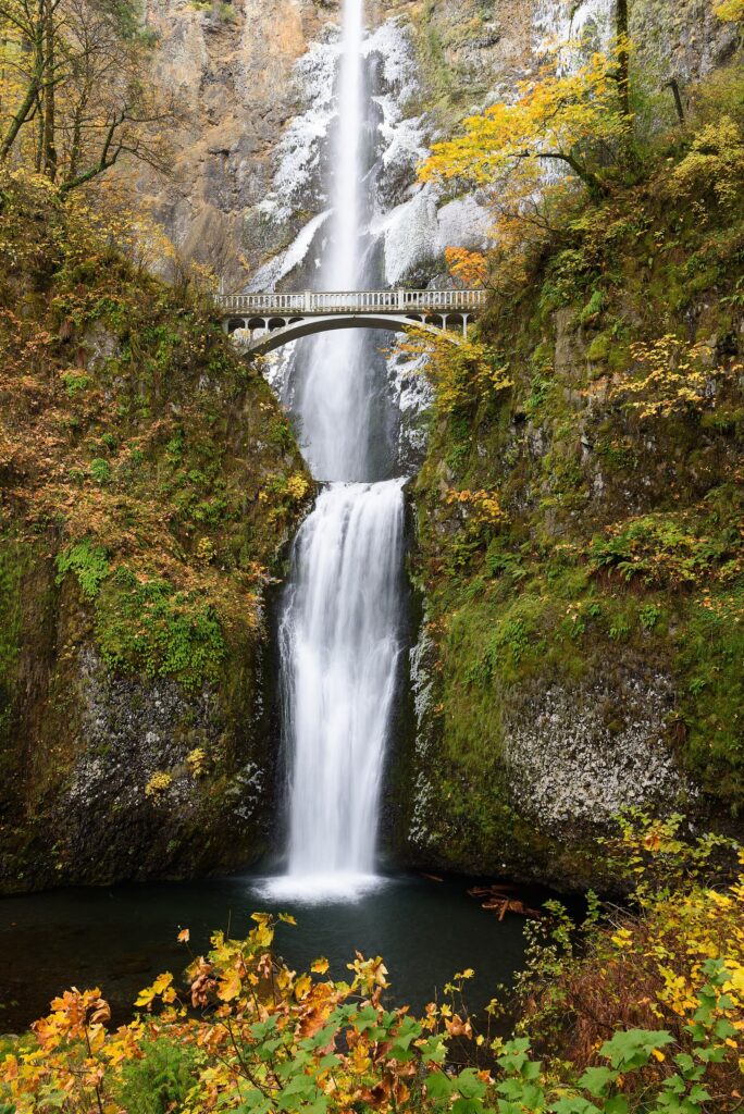
Multnomah Falls is the Gorge’s headline: a 620-foot waterfall in two tiers, with a stone lodge at its foot and the Benson Bridge spanning the gap between the upper and lower falls. From the parking areas, a short, paved walk leads to the lower viewing area, and that view, with both tiers stacked above you, is what most visitors come for. The historic lodge houses a restaurant, a gift shop, a snack bar, espresso and a Forest Service visitor center at its east end.
The Benson Bridge is a short, steady climb above the lower viewing area. Past it, the Larch Mountain Trail keeps going up paved switchbacks on the slope east of the falls to a viewing platform at the very top, where you can look straight down the upper falls to the lodge roof. Beyond that point the trail continues through old forest past Wiesendanger and Ecola falls, 6.8 miles in all to Larch Mountain.
The falls are named for the Multnomah, one of the Chinookan peoples of the lower Columbia, whose descendants belong to tribal nations in the region today. The stone lodge dates from 1925, and the Benson Bridge from 1914; it’s named for Simon Benson, the lumberman who once owned the falls and gave them to the City of Portland. The land has been managed by the Forest Service for decades now, which is why its alerts page is the one to check.
Two practical notes for fall 2026. The restrooms are closed for renovation through November 2026, with a limited number of portable toilets on site. And outside the permit season, the lot is first come, first served, so arrive before 9 a.m. on weekends or after 4 p.m. on long summer evenings.
Think twice if you only have an hour and it’s a sunny Saturday. You’ll spend much of it looking for parking. Come early, take the bus, or see Multnomah last on a weekday evening, when the tour groups have gone.
Latourell Falls and Shepperd’s Dell
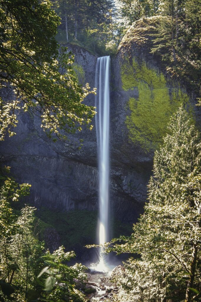
Latourell Falls is the first major waterfall you reach heading east on the Historic Highway, just below Crown Point in Guy W. Talbot State Park. It drops in a single ribbon over a curved wall of columnar basalt, streaked yellow with lichen, and the lower viewpoint is only a short walk from the parking lot. A loop trail continues up to the smaller upper falls and back, a good leg-stretcher if you want more than the view. Since March 30, 2026, the Latourell Falls trailhead is one of the sites where Oregon State Parks charges its day-use parking fee: $10 a day for Oregon residents and $12 for visitors.
Shepperd’s Dell, a little farther east, is the quick stop: a small falls tucked into a mossy chasm beneath one of the highway’s arched bridges, reached by a short flight of steps from the road. It takes five minutes, and it’s one of the prettiest five minutes on the drive. Vista House at Crown Point, just west of both, is free to enter, keeps seasonal hours and closes when winds top 50 mph.
Bridal Veil Falls
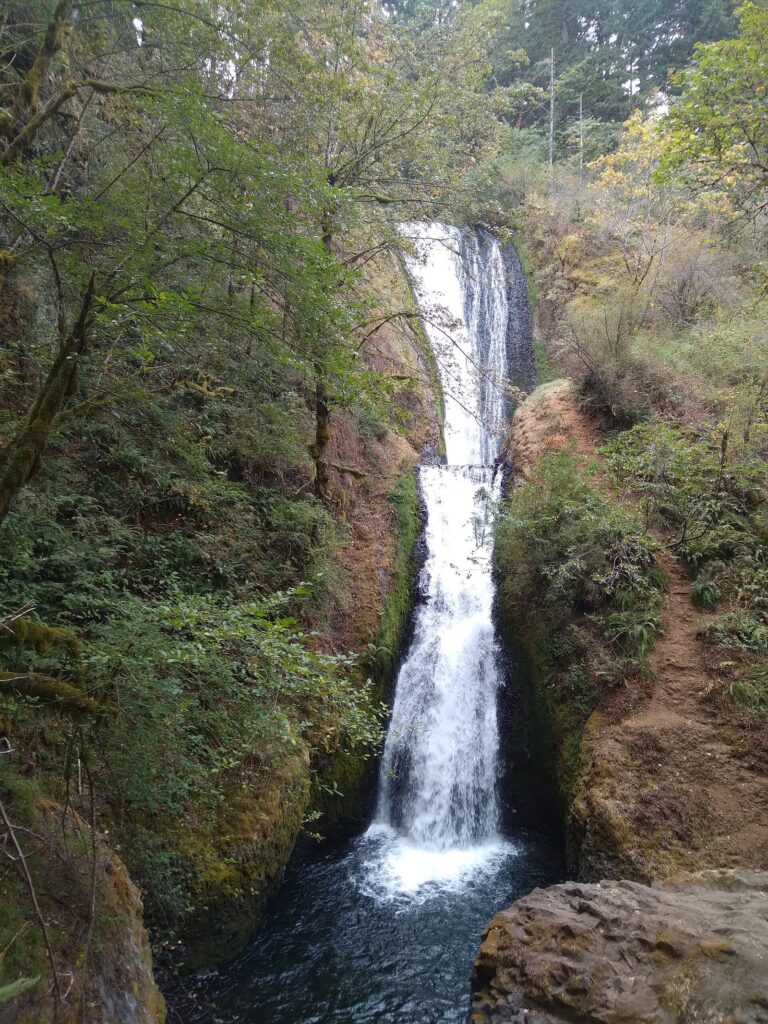
Bridal Veil Falls drops in two tiers into a narrow, leafy canyon. The trail to its base is short but steep, with stairs on the way down and, inevitably, on the way back up. A separate overlook loop from the same parking area stays on top of the bluff, with views across the river instead of the falls. The two trails suit different people: the falls trail for anyone who wants the waterfall up close, the overlook for anyone who’d rather skip the stairs.
Bridal Veil Falls State Scenic Viewpoint joined the list of parks charging the state day-use parking fee on March 30, 2026. From I-84, Exit 28 puts you on the Historic Highway right beside it.
From the same exit, the Angel’s Rest trailhead also began charging the state parking fee on March 30, 2026. Angel’s Rest is best known as a steep climb to a cliff-top view of the Gorge, but a short side path near its start leads to a viewpoint of Coopey Falls, a slender falls in a mossy side canyon, which makes a good bonus stop if you’re parked there anyway.
Wahkeena Falls and the loop to Multnomah
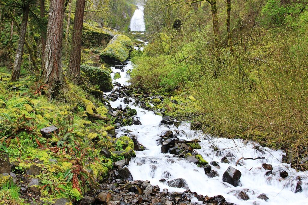
Wahkeena Falls, half a mile west of Multnomah, is the one people drive past by accident. It’s visible from near the road and the picnic area, a tall, lacy falls above a steep, tumbling cascade, and a paved trail climbs a short way to a stone bridge at its base.
It’s also the start of the Gorge’s favorite loop hike. The Wahkeena Trail climbs switchbacks past Fairy Falls to the plateau above, connects east to the Larch Mountain Trail and descends past the top of Multnomah Falls and down the paved switchbacks to the lodge, then returns to Wahkeena on a short connector trail. It’s a steep half-day walk rather than a stroll, with a waterfall around most corners, and it lets you park at Wahkeena while the Multnomah lot is full.
Horsetail, Ponytail and Triple Falls
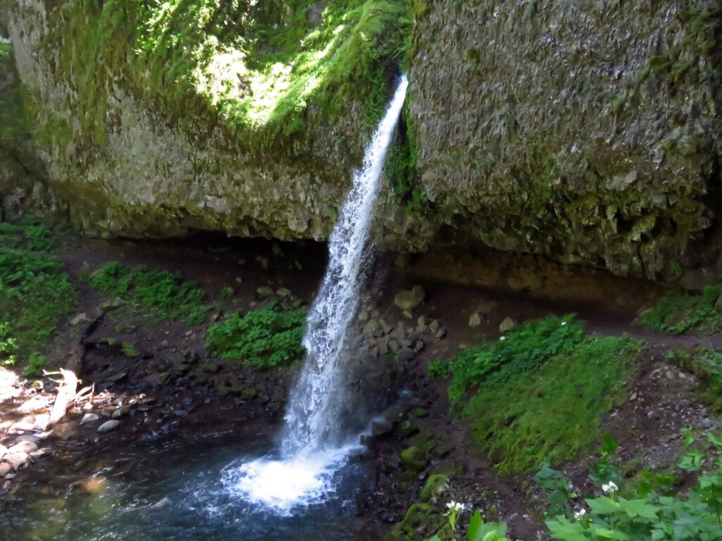
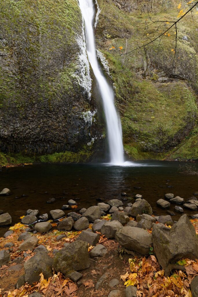
Horsetail Falls pours down right beside the Historic Highway near Ainsworth, and it’s the easiest waterfall in the Gorge: pull over, look up, done. The Horsetail Falls Trail, open in 2026, climbs from the same pullout to Ponytail Falls, also called Upper Horsetail, where the trail runs through a hollow in the basalt behind the falling water. It’s the shortest walk-behind waterfall near Portland, and the climb to reach it is steady rather than brutal.
Keep going and the trail joins the Oneonta Trail, which leads on to Triple Falls, three side-by-side chutes dropping into a mossy gorge, before looping back to the Horsetail junction. That’s a longer half-day hike and far quieter than the roadside stops.
One thing you can’t do is wade Oneonta Gorge, the narrow slot canyon just west of Horsetail. The creek route into the gorge remains closed in 2026, even though the Oneonta Trail itself is open. Old lists and social posts still show people scrambling over the log jam; don’t use them as evidence it’s open.
Which waterfall trails are closed in 2026?
The Gorge has been rebuilding since the 2017 Eagle Creek Fire, and storms keep adding new damage. As of September 24, 2026:
- Eagle Creek Trail and Wahclella Falls Trail are closed by Forest Service order from January 21 through October 31, 2026, because of hazards left by storms. That takes Punchbowl Falls and Wahclella Falls off the list for now.
- Oneonta Gorge‘s creek route is closed; the Oneonta Trail above it is open.
- The Historic Columbia River Highway State Trail, the car-free path along the old road, is closed between Eagle Creek and Cascade Locks after December 2025 storms and landslides buried it under boulders, trees and about 12 feet of material.
The backdrop to all of this is the Eagle Creek Fire, which started with fireworks on September 2, 2017 and burned tens of thousands of acres on the Oregon side of the Gorge. Trails reopened in stages over the following years, but burned slopes shed rock and trees more easily, and every hard winter seems to close something new.
When Wahclella reopens, it’s worth it: a moderate walk up the Tanner Creek canyon near Bonneville Dam to a two-tier falls in a mossy amphitheater. Its trailhead charges a day-use fee of $5 per vehicle or a valid recreation pass, paid by QR code, since cash and checks aren’t accepted. Check the Forest Service’s Columbia River Gorge alerts page before any Gorge hike; closures here change often, and the order’s end date isn’t a promise.
Silver Falls State Park and the Trail of Ten Falls
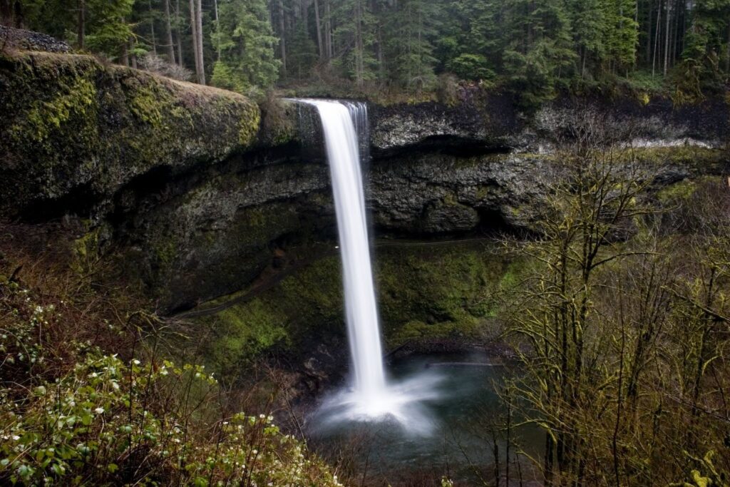
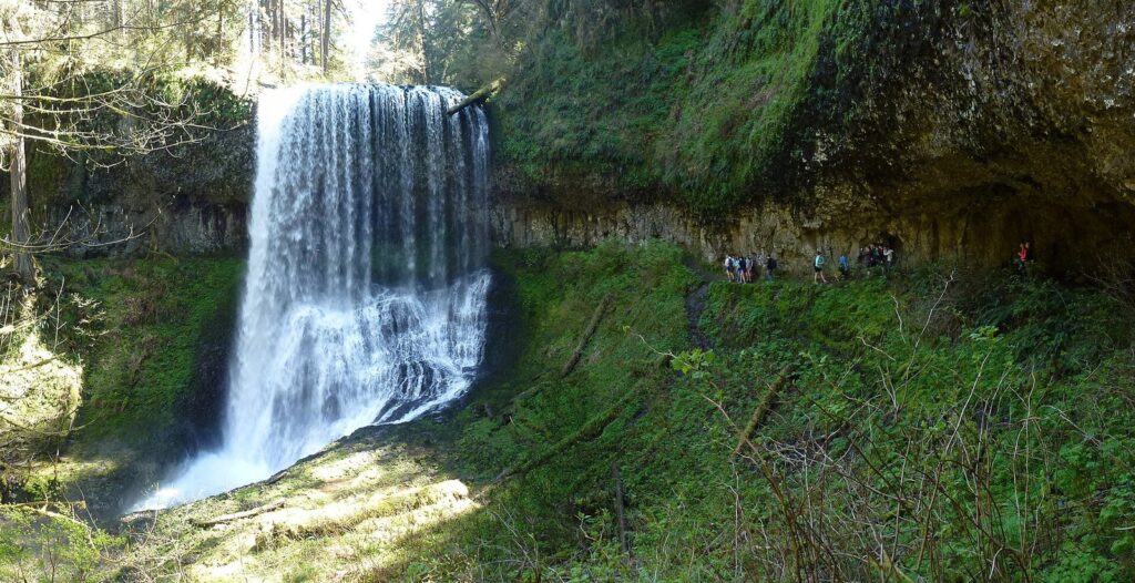
Silver Falls, Oregon’s largest state park, sits in the foothills east of Salem, about 1.5 hours south of Portland, and it’s the best single waterfall day in the region. Its Trail of Ten Falls is a 7.2-mile loop with about 800 feet of elevation change, made up of the Canyon Trail along the creek and the Rim Trail above it. Four of its falls have trails behind them: South Falls, which drops 177 feet, plus Lower South, North and Middle North falls.
You don’t have to do the whole loop. South Falls is a short walk from the main day-use area, and a shorter circuit takes in South and Lower South falls before climbing back to the rim. The park requires the state day-use parking permit, sold at both main areas, but there’s no registration or timed entry for the trail.
The stone South Falls Lodge, built by the Civilian Conservation Corps, anchors the main day-use area, with picnic lawns spread around it. In winter the park’s trails can ice over and storms sometimes close sections of the loop, so check the park’s special notices page before a cold-season visit.
Bring the dog and you’ll need a different plan: pets and bicycles aren’t allowed on the Canyon Trail or on the trails leading into the canyon, including Maple Ridge, Winter and Twin Falls. You can view South Falls with a pet, but not walk behind it.
Verdict: if you only have time for one waterfall hike, make it the Trail of Ten Falls. If you only have half a day, stay in the Gorge.
Waterfalls near Mount Hood
Two more waterfall hikes sit on Mount Hood’s flanks. Ramona Falls, on the west side, fans over columnar basalt at the end of a long forest loop in the Mount Hood Wilderness; you fill out a free wilderness permit at the trailhead from May 15 to October 15, and the trail crosses the Sandy River, which can run high and fast. Tamanawas Falls, off OR 35 on the east side, is a gentler walk along Cold Spring Creek to a wide curtain of water. Both are summer and early fall hikes, and both pair naturally with a mountain day; our guide to Mount Hood day trips covers the roads, passes and seasons.
Which waterfalls can you see without hiking?
Plenty. On the Historic Highway, several falls are visible from the car or a few minutes’ walk:
| Waterfall | How close to the car | Notes |
|---|---|---|
| Multnomah Falls | A short, paved walk to the lower viewing area | The most developed site, with the lodge and visitor center |
| Horsetail Falls | Beside the road | Pullout parking fills on weekends |
| Wahkeena Falls | Visible from near the road and picnic area | A short paved climb brings you closer |
| Latourell Falls | A short walk from the lot | State parks parking fee |
| Shepperd’s Dell | A short flight of steps from the road | Not step-free |
| South Falls, Silver Falls | A short walk from the main day-use area | State parks parking permit |
Step-free access varies from site to site and can change with construction or storm damage, so anyone using a wheelchair or stroller should check current conditions with the Forest Service or Oregon State Parks before counting on a viewpoint. Multnomah’s lower viewing area is the most developed of the group.
How do you avoid the crowds?
Multnomah Falls draws huge crowds, and the rest of the corridor fills in behind it. The fixes are simple and they all involve the clock. On weekends, be at your first waterfall by 9 a.m.; by late morning the pullouts are full and the Historic Highway turns into a slow parade of drivers looking for a space. On long summer evenings the tour groups leave and the light softens, which makes 5 p.m. to sunset the second-best window.
Weekdays beat weekends everywhere, and rain beats sunshine: a drizzly Tuesday in April shows the falls at full power with a fraction of the people. Spring break weeks and the first warm Saturday of the year are the worst days to go. At Silver Falls the same rules apply, and the far end of the loop, around North and Middle North falls, is always quieter than South Falls.
What should you bring?
Shoes with grip matter more than anything else, since the paths around the falls stay wet all year and the paved ones get slick with spray and leaves. Bring a rain shell even on a dry day, because spray soaks you near the bigger falls, plus water and a snack for any trail beyond the lower viewpoints. Download a map before you leave, since coverage is patchy in the Gorge, and have a phone with a card or pay app ready: Oregon State Parks sells permits by QR code and online, and Wahclella’s trailhead takes no cash at all. If you’re carrying a camera, a cloth for the lens will earn its place within the first five minutes at Multnomah.
When is the best time to see the waterfalls?
| Season | What you’ll find | Watch for |
|---|---|---|
| Winter (December to February) | Strong flow, few crowds, sometimes ice sculptures around the falls | Ice on trails and the Historic Highway; wind closures at Vista House |
| Spring (March to June) | Peak flow from rain and snowmelt, wildflowers on the Gorge’s slopes | Muddy trails; weekend crowds from April |
| Summer (July to early September) | Dry trails, long days | Lower flow, Multnomah’s timed permits, full lots, fire restrictions |
| Fall (late September to November) | Autumn color, returning rain, quieter weekdays | Short days; storm damage and new closures |
Rain is the waterfall hunter’s friend. A wet weekday in spring shows the Gorge at full power with half the crowds of a dry Saturday in July, and a rain shell and shoes with grip are all you need. For Portland’s side of the calendar, see the best time to visit Portland, Oregon.
How do you stay safe at the waterfalls?
The Gorge’s waterfalls are easy to reach and easy to underestimate. Rock around the falls stays wet and slick all year, and the cliffs above them are steeper than they look from the trail. Stay on the trail and behind railings, never climb on the falls themselves, and keep children close at overlooks.
The 2017 fire left loose ground and damaged trees in places, and winter storms keep dropping rocks and limbs onto trails, which is why closures here are frequent. Obey closure signs even when the trail beyond looks fine. Poison oak grows along some Gorge trails, especially on the sunnier slopes, and cell coverage drops out in parts of the Gorge, so download a map before you leave. In winter, ice can coat the paved paths at Multnomah and Latourell, and the Historic Highway itself can close in snow or ice.
Two waterfall days that work
1. The Gorge corridor in half a day
Leave Portland by 8 a.m. and drive the Historic Highway east from Corbett: Vista House for the view, then Latourell, Shepperd’s Dell and Bridal Veil. Reach Multnomah Falls before 10, walk up to the Benson Bridge, then finish at Horsetail Falls and climb to Ponytail if you have an hour left. Return on I-84. If you have the whole day, continue east to Cascade Locks and Hood River for lunch.
2. Silver Falls in a day
Drive south on I-5 and east through the foothills, arriving by 9:30 to beat the parking rush. Walk the full Trail of Ten Falls counterclockwise from South Falls, which puts the walk-behind falls in the first half, and budget four to five hours with stops. Pack lunch; the park’s day-use areas are made for it.
If you’re building a longer stay around the waterfalls, our Portland itineraries show which day to give the Gorge.
Waterfalls Near Portland FAQ
Is Multnomah Falls free to visit?
There’s no entry fee, and outside summer the parking is free too. From May 22 to September 7, 2026, parking in the I-84 lot between 9 a.m. and 6 p.m. required a $2 timed permit plus a $2 transaction fee. Arriving on the Historic Highway, by bus, on foot or by bike avoided the permit entirely.
Can you walk behind a waterfall near Portland?
Yes. In the Gorge, the Horsetail Falls Trail passes behind Ponytail Falls after a steady climb from the highway. At Silver Falls State Park, four falls have trails behind them: South, Lower South, North and Middle North. South Falls is the easiest, a short walk from the main parking area.
What is the closest waterfall to downtown Portland?
Among the big ones, Latourell Falls, the first major falls heading east on the Historic Highway beyond Crown Point. Multnomah Falls, about 30 miles from downtown, is only a few minutes farther along the same road, so most people see both on the same drive.
How long does it take to see the Gorge waterfalls?
About three to four hours for the roadside falls on the Historic Highway, from Latourell to Horsetail, with short walks at each and a climb to the Benson Bridge. Add two to three hours for a loop hike such as Wahkeena to Multnomah, and a full day if you continue east to Cascade Locks and Hood River.
Is Oneonta Gorge open?
No. The creek route into Oneonta Gorge remains closed in 2026. The Oneonta Trail, which climbs above the gorge to Triple Falls, is open, and you can reach it from the Horsetail Falls trailhead. Check the Forest Service’s alerts page for changes before you go.
Are dogs allowed at the waterfalls?
On most Gorge trails, leashed dogs are fine, but crowds at Multnomah and slippery stairs at Bridal Veil make them hard work. At Silver Falls, dogs aren’t allowed on the Canyon Trail or on the trails leading into the canyon, so the Trail of Ten Falls loop is off-limits with a pet.
Can you see the waterfalls in winter?
Yes, and they’re often at their most powerful. Go on a day without snow or ice in the forecast, bring shoes with grip, and check TripCheck, since the Historic Highway can close in bad weather. Vista House closes when winds top 50 mph, which in winter is more often than you’d think.
Related Portland Guides
- Columbia River Gorge from Portland: the routes, towns and viewpoints between the waterfalls
- Mount Hood Day Trips from Portland: Ramona and Tamanawas falls with the mountain’s lakes and lodge
- Day Trips from Portland, Oregon: the Gorge and Silver Falls compared with the coast and wine country
- Getting Around Portland, Oregon: MAX to Gateway for the Gorge bus
- Best Time to Visit Portland, Oregon: rain, flow and crowds month by month
Sources and verification
Details on this page were checked on September 24, 2026 against the agencies and operators listed below. The page is compiled from their published information and claims no first-hand visits.
- Forest Service: Multnomah Falls
- Forest Service: Larch Mountain Trail #441
- Forest Service: Horsetail Falls Trail #438
- Forest Service: Oneonta Trail #424
- Forest Service: Eagle Creek and Wahclella Falls trails closure order
- Forest Service: Wahclella Falls Trailhead
- Forest Service: Columbia River Gorge alerts
- Multnomah Falls Lodge: hiking trails
- ODOT: waterfall corridor permits
- Recreation.gov: Multnomah Falls timed entry
- ODOT: Historic Columbia River Highway closure and repairs (2025)
- Oregon State Parks: parking fee at additional parks from March 30, 2026
- Oregon State Parks: Silver Falls State Park
- Oregon State Parks: Vista House at Crown Point
- Columbia Area Transit: Columbia Gorge Express
- ODOT TripCheck: road conditions
Portland Tourism Guide is an independent publication, not affiliated with Travel Portland, the City of Portland or any business named here.
Photo credits
- Middle North Falls: photo by Little Mountain 5, Wikimedia Commons (CC BY-SA 4.0)
- Multnomah Falls: photo by King of Hearts, Wikimedia Commons (CC BY-SA 4.0)
- Latourell Falls: photo by Steven Pavlov, Wikimedia Commons (CC BY-SA 4.0)
- Bridal Veil Falls: photo by Bobjgalindo, Wikimedia Commons (CC BY-SA 4.0)
- Wahkeena Falls: photo by John Murphy, Wikimedia Commons (CC BY-SA 2.0)
- Ponytail Falls: photo by Jeffhollett, Wikimedia Commons (CC BY-SA 4.0)
- Horsetail Falls: photo by King of Hearts, Wikimedia Commons (CC BY-SA 4.0)
- South Falls, Silver Falls State Park: photo by Kelvin Kay — Kkmd at English Wikipedia, Wikimedia Commons (CC BY-SA 3.0)